MyTopo
Hochheim Texas US Topo Map
Couldn't load pickup availability
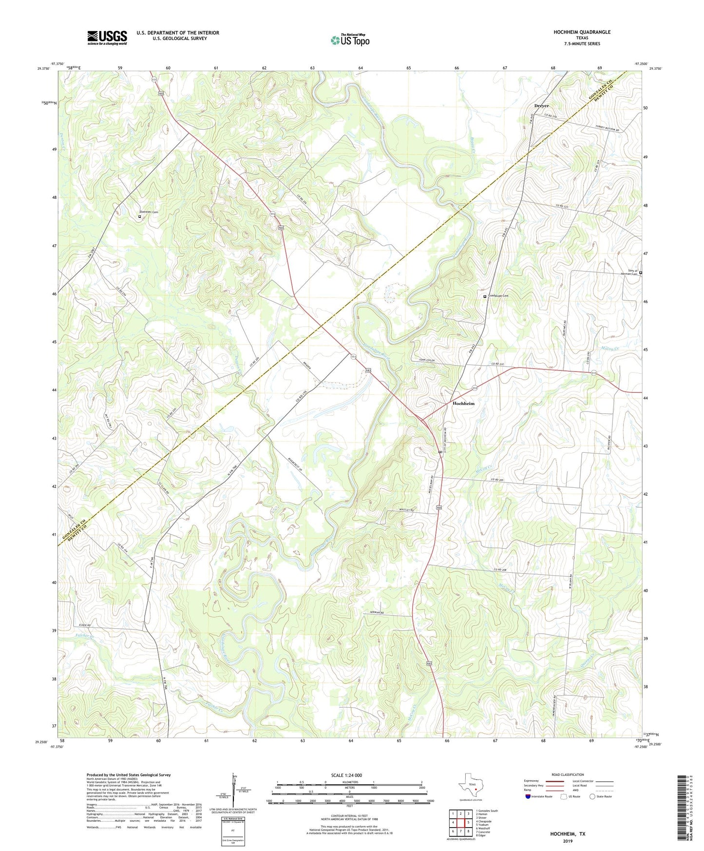
2022 topographic map quadrangle Hochheim in the state of Texas. Scale: 1:24000. Based on the newly updated USGS 7.5' US Topo map series, this map is in the following counties: DeWitt, Gonzales. The map contains contour data, water features, and other items you are used to seeing on USGS maps, but also has updated roads and other features. This is the next generation of topographic maps. Printed on high-quality waterproof paper with UV fade-resistant inks.
Quads adjacent to this one:
West: Cheapside
Northwest: Gonzales South
North: Hamon
Northeast: Shiner
East: Yoakum
Southeast: Edgar
South: Concrete
Southwest: Westhoff
This map covers the same area as the classic USGS quad with code o29097c3.
Contains the following named places: Boggy Creek, Denton Creek, Dreyer, Ebenezer Cemetery, Fulcher Creek, Guadalupe Cemetery, Hochheim, Hochheim Post Office, Mount Nebo Church, Queens Creek, Sons of Herman Cemetery, Steen, Turkey Bottom