MyTopo
Edgar Texas US Topo Map
Couldn't load pickup availability
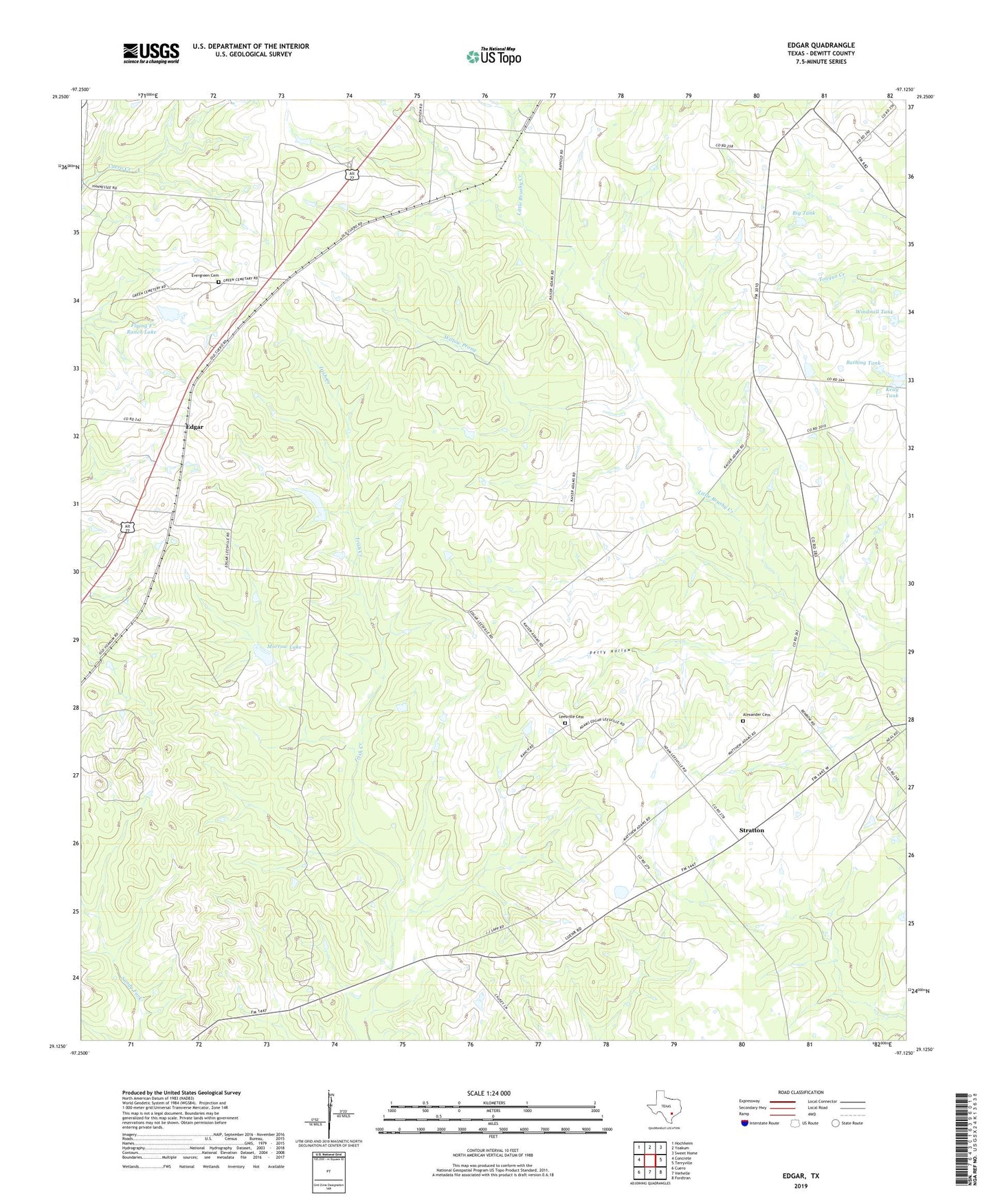
2022 topographic map quadrangle Edgar in the state of Texas. Scale: 1:24000. Based on the newly updated USGS 7.5' US Topo map series, this map is in the following counties: DeWitt. The map contains contour data, water features, and other items you are used to seeing on USGS maps, but also has updated roads and other features. This is the next generation of topographic maps. Printed on high-quality waterproof paper with UV fade-resistant inks.
Quads adjacent to this one:
West: Concrete
Northwest: Hochheim
North: Yoakum
Northeast: Sweet Home
East: Terryville
Southeast: Fordtran
South: Verhelle
Southwest: Cuero
This map covers the same area as the classic USGS quad with code o29097b2.
Contains the following named places: Alexander Cemetery, Bathing Tank, Big Tank, Edgar, Evergreen Cemetery, Flying F Ranch Lake, Flying F Ranch Lake Dam, Kelly Tank, Leesville Cemetery, Leesville Church, Morrow Dam, Morrow Lake, Mount Zion Church, Petty Hollow, Stratton, Willow Prong, Windmill Tank, Yoakum Division