MyTopo
Coon Creek Lake Texas US Topo Map
Couldn't load pickup availability
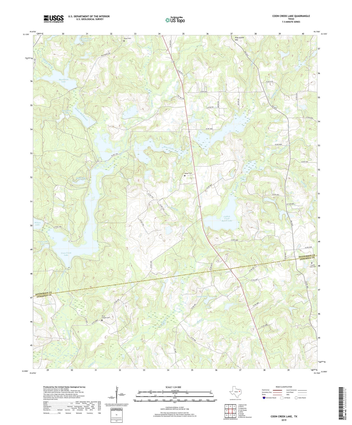
2019 topographic map quadrangle Coon Creek Lake in the state of Texas. Scale: 1:24000. Based on the newly updated USGS 7.5' US Topo map series, this map is in the following counties: Henderson, Anderson. The map contains contour data, water features, and other items you are used to seeing on USGS maps, but also has updated roads and other features. This is the next generation of topographic maps. Printed on high-quality waterproof paper with UV fade-resistant inks.
Quads adjacent to this one:
West: Cross Roads
Northwest: Mallard Hill
North: Athens
Northeast: Leagueville
East: LaRue
Southeast: Wilkerson Mountain
South: Blackfoot
Southwest: Cayuga
Contains the following named places: Black Lake, Black Lake Dam, Carroll Spring Church, Cartwright Dam, Cartwright Lake, Catfish Creek Ranch Lake, Catfish Creek Ranch Lake Dam, Coon Creek Lake, Coon Creek Lake Dam, County Line Cemetery, Goldman Branch, Koon Kreek Klub, Lucky Lake, Lucky Lake Dam, Lunceford Lake, Lunceford Lake Dam, Mine Creek, Modoc Cemetery, Modoc Church, Murchison Lake, Murchison Lake Dam, Old Lake, Old Lake Dam, Owen Cemetery, Pickle Branch, Pine Grove Hill, Price Chapel Cemetery, Shelton Lake, Shelton Lake Dam, Shelton Mill Branch, Slaughter Lake Number 1 Dam, Slaughter Lakes, Soutter Lake, Soutter Lake Dam, Stroube Dam Number 1, Stroube Lake Number 1, Terra Verda Lake, Terra Verda Lake Dam, Terrell Branch, Wilson Lake Dam, Wolf Creek