MyTopo
Cayuga Texas US Topo Map
Couldn't load pickup availability
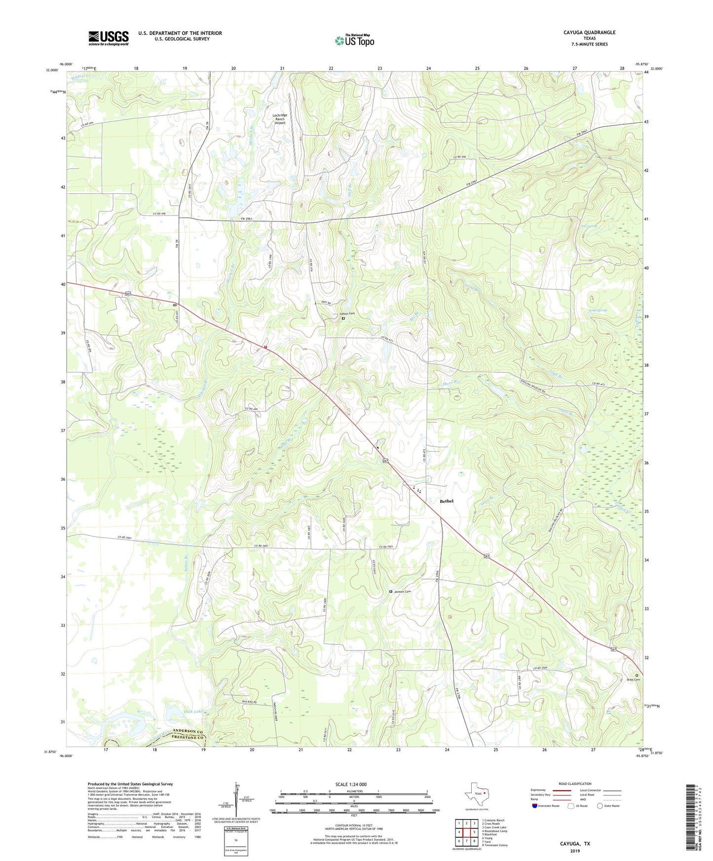
2022 topographic map quadrangle Cayuga in the state of Texas. Scale: 1:24000. Based on the newly updated USGS 7.5' US Topo map series, this map is in the following counties: Anderson, Freestone. The map contains contour data, water features, and other items you are used to seeing on USGS maps, but also has updated roads and other features. This is the next generation of topographic maps. Printed on high-quality waterproof paper with UV fade-resistant inks.
Quads adjacent to this one:
West: Roustabout Camp
Northwest: Creslenn Ranch
North: Cross Roads
Northeast: Coon Creek Lake
East: Blackfoot
Southeast: Tennessee Colony
South: Yard
Southwest: Young
This map covers the same area as the classic USGS quad with code o31095h8.
Contains the following named places: Bee Branch, Bethel, Bethel Cayuga Volunteer Fire Department, Bethel Church, Bethel School Number 2, Cayuga, Cayuga Division, Cayuga High School, Cayuga Post Office, Cayuga School, Cox Lake, Cox Lake Dam, Crawford Branch, DD Spring, Duck Lake, Gus Engeling Wildlife Management Area, Hall Branch, Jackson Cemetery, Judson Cemetery, Judson Church, Kidd Spring, Lochridge Ranch Airport, Lone Pine Church, Long Branch, Mitchell Branch, New Bethel Church, Saline Branch, Shaw Cemetery, Short Branch, Skeet Branch, ZIP Code: 75832