MyTopo
Cross Roads Texas US Topo Map
Couldn't load pickup availability
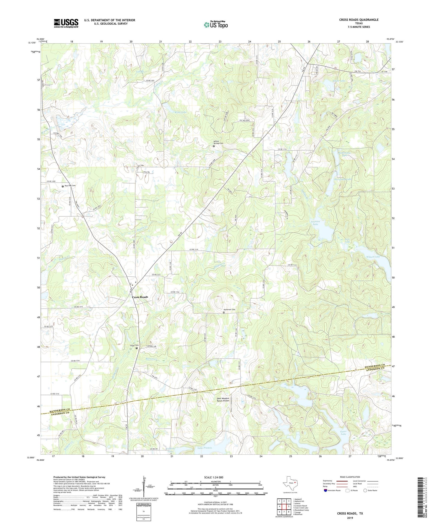
2022 topographic map quadrangle Cross Roads in the state of Texas. Scale: 1:24000. Based on the newly updated USGS 7.5' US Topo map series, this map is in the following counties: Henderson, Anderson. The map contains contour data, water features, and other items you are used to seeing on USGS maps, but also has updated roads and other features. This is the next generation of topographic maps. Printed on high-quality waterproof paper with UV fade-resistant inks.
Quads adjacent to this one:
West: Creslenn Ranch
Northwest: Malakoff
North: Mallard Hill
Northeast: Athens
East: Coon Creek Lake
Southeast: Blackfoot
South: Cayuga
Southwest: Roustabout Camp
This map covers the same area as the classic USGS quad with code o32095a8.
Contains the following named places: Anding Branch, Barron Creek, Bass Haven Lake, Bass Haven Lake Dam, Beck Chapel, Catfish Lake, Catfish Lake Dam, Cayuga Oil Field, Corinth Church, Cross Roads, Cross Roads Elementary School, Cross Roads School, Deer Meadow Ranch Airport, Gator Lake, Gator Lake Dam, Jonnson Lake, Jonsson Lake Dam, Kline Lake, Kline Lake Dam, Lake Francis, Lake Francis Dam, McElvaney Lake, Nichols Lake, Nichols Lake Dam, Patterson Cemetery, Perryman Lake, Perryman Lake Dam, Post Oak Cemetery, Ranch House Lake, Ranch House Lake Dam, Shady Oaks, Slaughter Lake, Soil Conservation Service Site 2 Dam, Tarr Lake, Tarr Pond Dam, Tick Branch, Triple S Ranch Lake Dam, Union Cemetery, White Lake, White Lake Dam, Willow Springs Cemetery, Willow Springs Church, Wilson Lake, ZIP Code: 75751