MyTopo
LaRue Texas US Topo Map
Couldn't load pickup availability
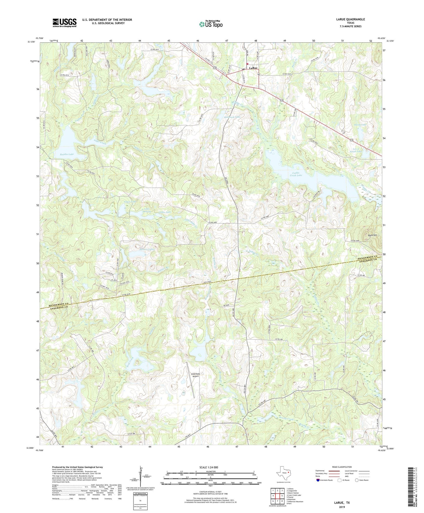
2022 topographic map quadrangle LaRue in the state of Texas. Scale: 1:24000. Based on the newly updated USGS 7.5' US Topo map series, this map is in the following counties: Henderson, Anderson. The map contains contour data, water features, and other items you are used to seeing on USGS maps, but also has updated roads and other features. This is the next generation of topographic maps. Printed on high-quality waterproof paper with UV fade-resistant inks.
Quads adjacent to this one:
West: Coon Creek Lake
Northwest: Athens
North: Leagueville
Northeast: Moore Station
East: Poynor
Southeast: Pert
South: Wilkerson Mountain
Southwest: Blackfoot
This map covers the same area as the classic USGS quad with code o32095a6.
Contains the following named places: Alder Creek, Alder Creek Dam, Caddo Creek Lake, Caddo Creek Lake Dam, Dennis Lake, Dennis Lake Dam, Fincastle Lake, Fincastle Lake Dam, Glad Oaks Airport, Grass Lake, Grass Lake Dam, Greenbrier Lake, Greenbrier Lake Dam, Hallmark Lake, Hallmark Lake Dam, Horn Lake, Horn Lake Dam, Johns Lake, Johns Lake Dam, Kile Branch, KYYK-FM (Palestine), La Poynor Elementary School, La Poynor School, Lake CWM Dam, Lake JDM, Lake JDM Dam, Lake Mawsy, Lake Mawsy Dam, LaRue, Larue - New York Volunteer Fire Department Station 1, Larue Baptist Church, Larue Post Office, Leo A Smith Lake, Leo A Smith Lake Dam, Little Alder Creek, Meadowood Ranch Heliport, Midway Church, North Lake, North Lake Dam, Palmer Branch, Pharris Lakes, Pierce Creek, Rainbo Lake, Rainbo Lake Dam, Rock Hill, Rock Hill Church, Site C Dam, Site C Reservoir, Union Church