MyTopo
Cooper North Texas US Topo Map
Couldn't load pickup availability
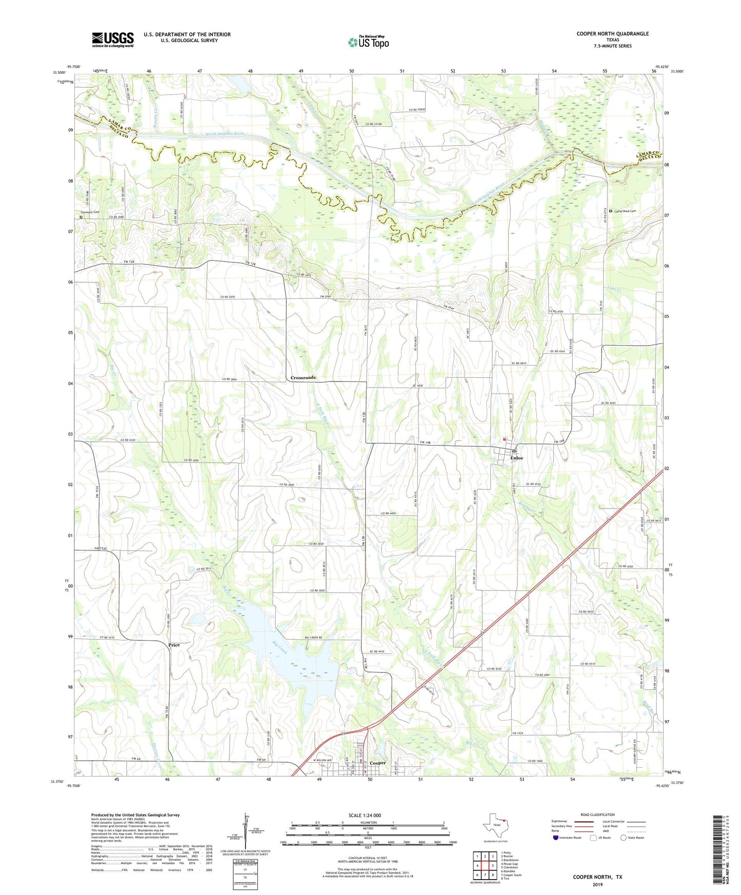
2019 topographic map quadrangle Cooper North in the state of Texas. Scale: 1:24000. Based on the newly updated USGS 7.5' US Topo map series, this map is in the following counties: Delta, Lamar. The map contains contour data, water features, and other items you are used to seeing on USGS maps, but also has updated roads and other features. This is the next generation of topographic maps. Printed on high-quality waterproof paper with UV fade-resistant inks.
Quads adjacent to this one:
West: Pecan Gap
Northwest: Petty
North: Roxton
Northeast: Biardstown
East: Charleston
Southeast: Tira
South: Cooper South
Southwest: Klondike
Contains the following named places: Camp Shed Cemetery, Cane Creek, Clara Foster Slough Museum, Crossroads, Delta County, Delta County Emergency District EMS, East Fork Big Creek, Enloe, Enloe Post Office, Enloe Volunteer Fire Department, Love Chapel Church of God in Christ, Maxwell Creek, New Life Baptist Church, Price, Racetrack, Rowdy Creek, Simmons Cemetery, ZIP Codes: 75432, 75441