MyTopo
Klondike Texas US Topo Map
Couldn't load pickup availability
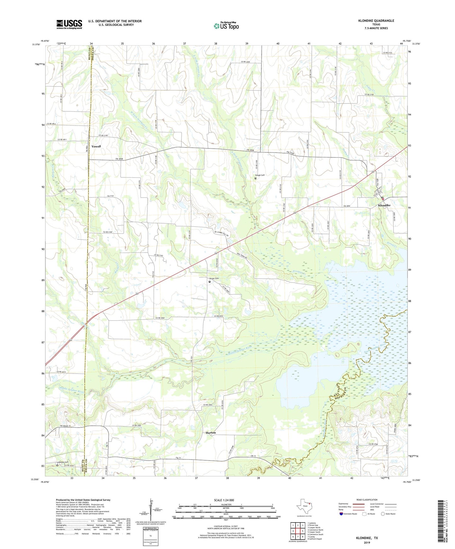
2022 topographic map quadrangle Klondike in the state of Texas. Scale: 1:24000. Based on the newly updated USGS 7.5' US Topo map series, this map is in the following counties: Delta, Hunt, Hopkins. The map contains contour data, water features, and other items you are used to seeing on USGS maps, but also has updated roads and other features. This is the next generation of topographic maps. Printed on high-quality waterproof paper with UV fade-resistant inks.
Quads adjacent to this one:
West: Commerce North
Northwest: Ladonia
North: Pecan Gap
Northeast: Cooper North
East: Cooper South
Southeast: Gafford Chapel
South: Cumby
Southwest: Commerce South
This map covers the same area as the classic USGS quad with code o33095c7.
Contains the following named places: Barnett Creek, East Fork Jernigan Creek, Emblem Church, Gough, Gough Cemetery, Horton, Jernigan Creek, Klondike, Klondike Post Office, Klondike Volunteer Fire Department, Lebanon Cemetery, Middle Sulphur River, Needmore, Pecan Creek, Pecan Gap Division, Shiloh Cemetery, Shiloh Church, West Delta, West Fork Jernigan Creek, Wintermute Memorial Hospital, Yowell, ZIP Code: 75448