MyTopo
Pecan Gap Texas US Topo Map
Couldn't load pickup availability
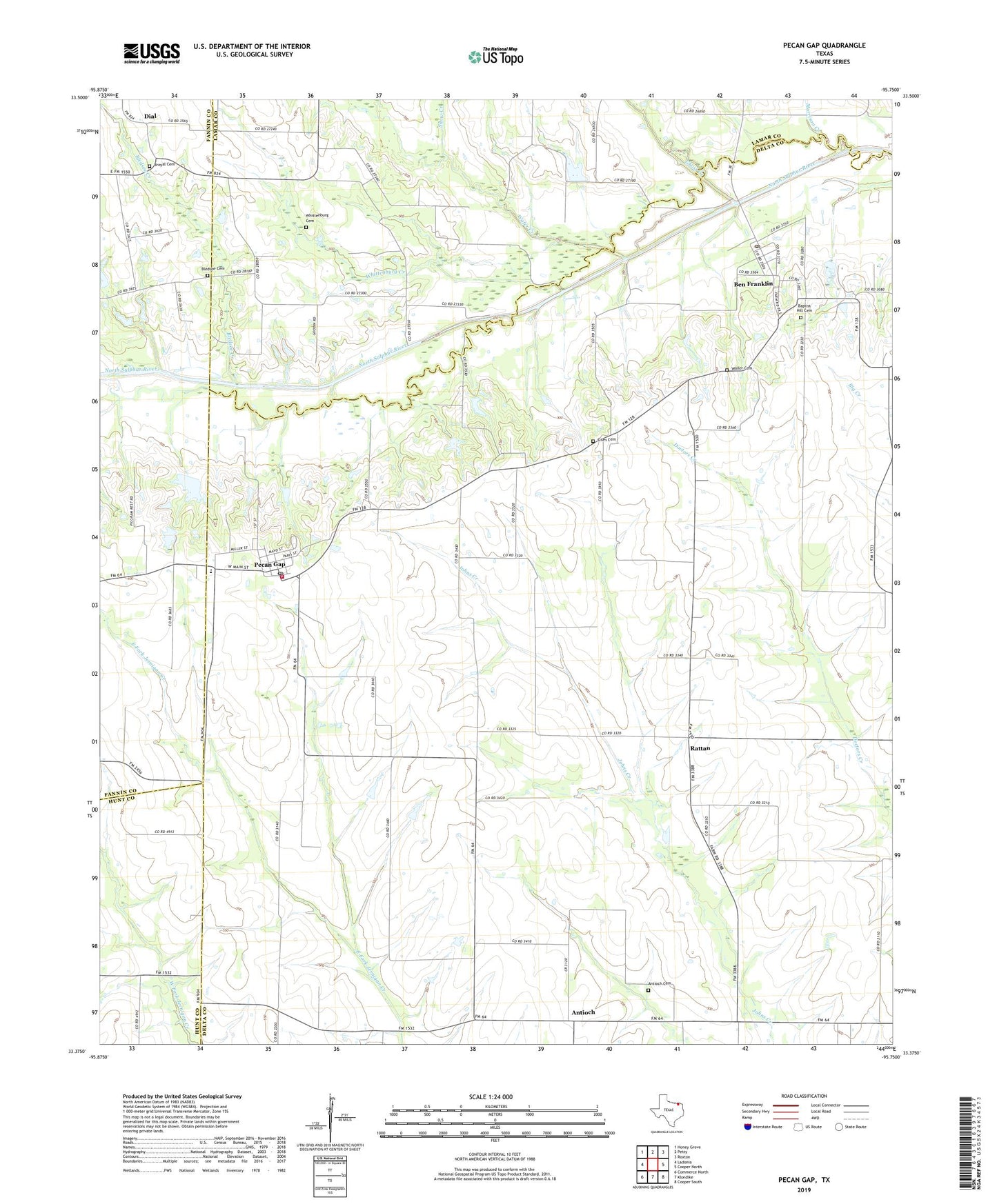
2022 topographic map quadrangle Pecan Gap in the state of Texas. Scale: 1:24000. Based on the newly updated USGS 7.5' US Topo map series, this map is in the following counties: Delta, Lamar, Fannin, Hunt. The map contains contour data, water features, and other items you are used to seeing on USGS maps, but also has updated roads and other features. This is the next generation of topographic maps. Printed on high-quality waterproof paper with UV fade-resistant inks.
Quads adjacent to this one:
West: Ladonia
Northwest: Honey Grove
North: Petty
Northeast: Roxton
East: Cooper North
Southeast: Cooper South
South: Klondike
Southwest: Commerce North
This map covers the same area as the classic USGS quad with code o33095d7.
Contains the following named places: Antioch, Antioch Cemetery, Baptist Hill Cemetery, Ben Franklin, Ben Franklin Post Office, Bledsoe Cemetery, Bledsoe Creek, Broyal Cemetery, City of Pecan Gap, Dial, Dial Cemetery, Fannindel Elementary School, Friendship Baptist Church, Ghost Creek, Giles Cemetery, Jot Em Down, Jot-Em-Down, Morrison Creek, Pecan Gap, Pecan Gap City Hall, Pecan Gap Post Office, Pecan Gap Volunteer Fire Department, Rattan, Snow Creek, Wafer Creek, Waller Cemetery, Whittenburg Cemetery, Whittenburg Creek, ZIP Codes: 75415, 75469