MyTopo
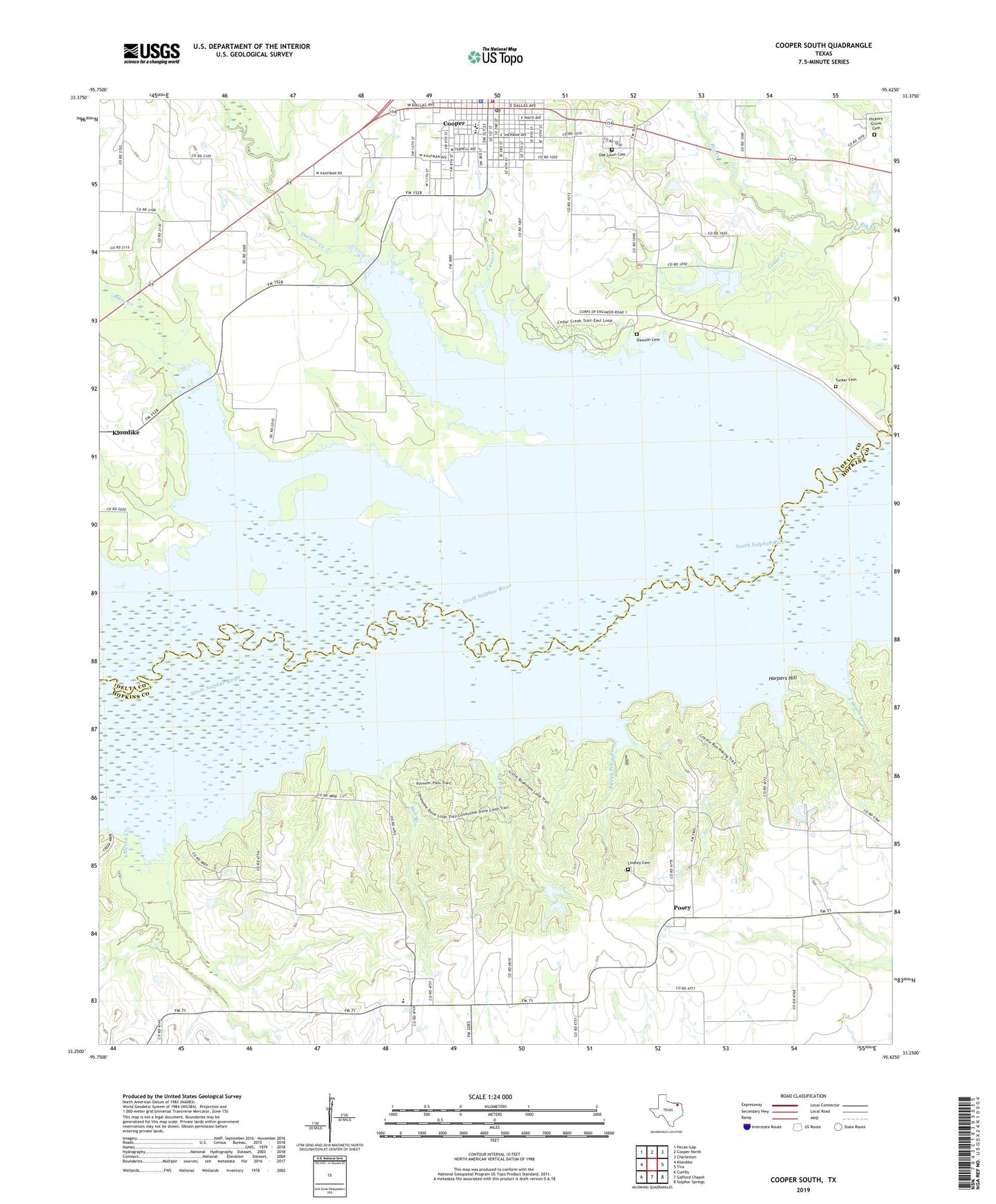
Cooper South Texas US Topo Map
Couldn't load pickup availability
2019 topographic map quadrangle Cooper South in the state of Texas. Scale: 1:24000. Based on the newly updated USGS 7.5' US Topo map series, this map is in the following counties: Delta, Hopkins. The map contains contour data, water features, and other items you are used to seeing on USGS maps, but also has updated roads and other features. This is the next generation of topographic maps. Printed on high-quality waterproof paper with UV fade-resistant inks.
Quads adjacent to this one:
West: Klondike
Northwest: Pecan Gap
North: Cooper North
Northeast: Charleston
East: Tira
Southeast: Sulphur Springs
South: Gafford Chapel
Southwest: Cumby
Contains the following named places: Buggy Whip Creek, Cannon Creek, Cedar Creek, Church of Christ, City Lake Dam Number 1, City Lake Dam Number 2, City Lake Number 1, City Lake Number 2, City Lakes, City Lakes Dam 3, City of Cooper, Cooper, Cooper City Hall, Cooper Dam, Cooper Elementary School, Cooper High School, Cooper Junior High School, Cooper Lake State Park - Doctors Creek Unit, Cooper Lake State Park - South Sulphur Unit, Cooper Lake State Parks Trail, Cooper Lake Wildlife Management Area, Cooper Post Office, Dawson Cemetery, Deep Well Crossing, Delta County Constable's Office, Delta County Courthouse, Delta County Patterson Memorial Museum, Delta County Sheriff's Department, Delta County Sheriff's Office, Doctors Creek, Faith Fundamental Independent Baptist Church, Finley Branch, First Baptist Church, Free Hope Church, Friendship, Harmon Park, Harpers Crossing, Harpers Hill, Hickory Grove Cemetery, Honey Creek, Jim Chapman Lake, Johns Creek, Liberty Grove, Liberty Grove Cemetery, Lindley Cemetery, Merrit Creek, Mill Branch, Moore Creek, New Zion Baptist Church, Oak Lawn Cemetery, Peerless, Posey, Tucker Cemetery