MyTopo
Coyanosa Texas US Topo Map
Couldn't load pickup availability
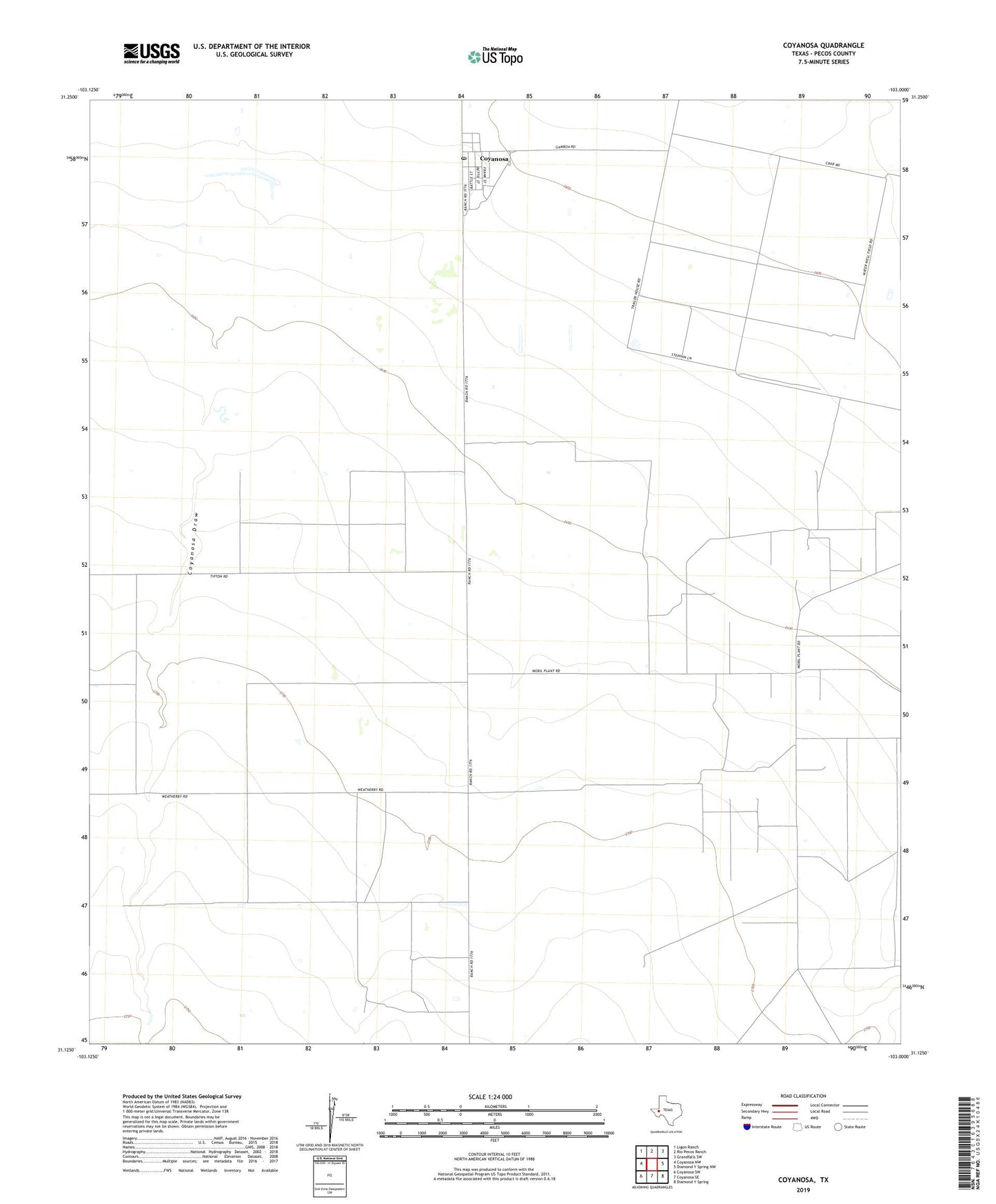
2022 topographic map quadrangle Coyanosa in the state of Texas. Scale: 1:24000. Based on the newly updated USGS 7.5' US Topo map series, this map is in the following counties: Pecos. The map contains contour data, water features, and other items you are used to seeing on USGS maps, but also has updated roads and other features. This is the next generation of topographic maps. Printed on high-quality waterproof paper with UV fade-resistant inks.
Quads adjacent to this one:
West: Coyanosa NW
Northwest: Ligon Ranch
North: Rio Pecos Ranch
Northeast: Grandfalls SW
East: Diamond Y Spring NW
Southeast: Diamond Y Spring
South: Coyanosa SE
Southwest: Coyanosa SW
This map covers the same area as the classic USGS quad with code o31103b1.
Contains the following named places: Athey Oil and Gas Field, Coyanosa, Coyanosa Census Designated Place, Coyanosa Post Office, ZIP Code: 79730