MyTopo
Crosbyton Texas US Topo Map
Couldn't load pickup availability
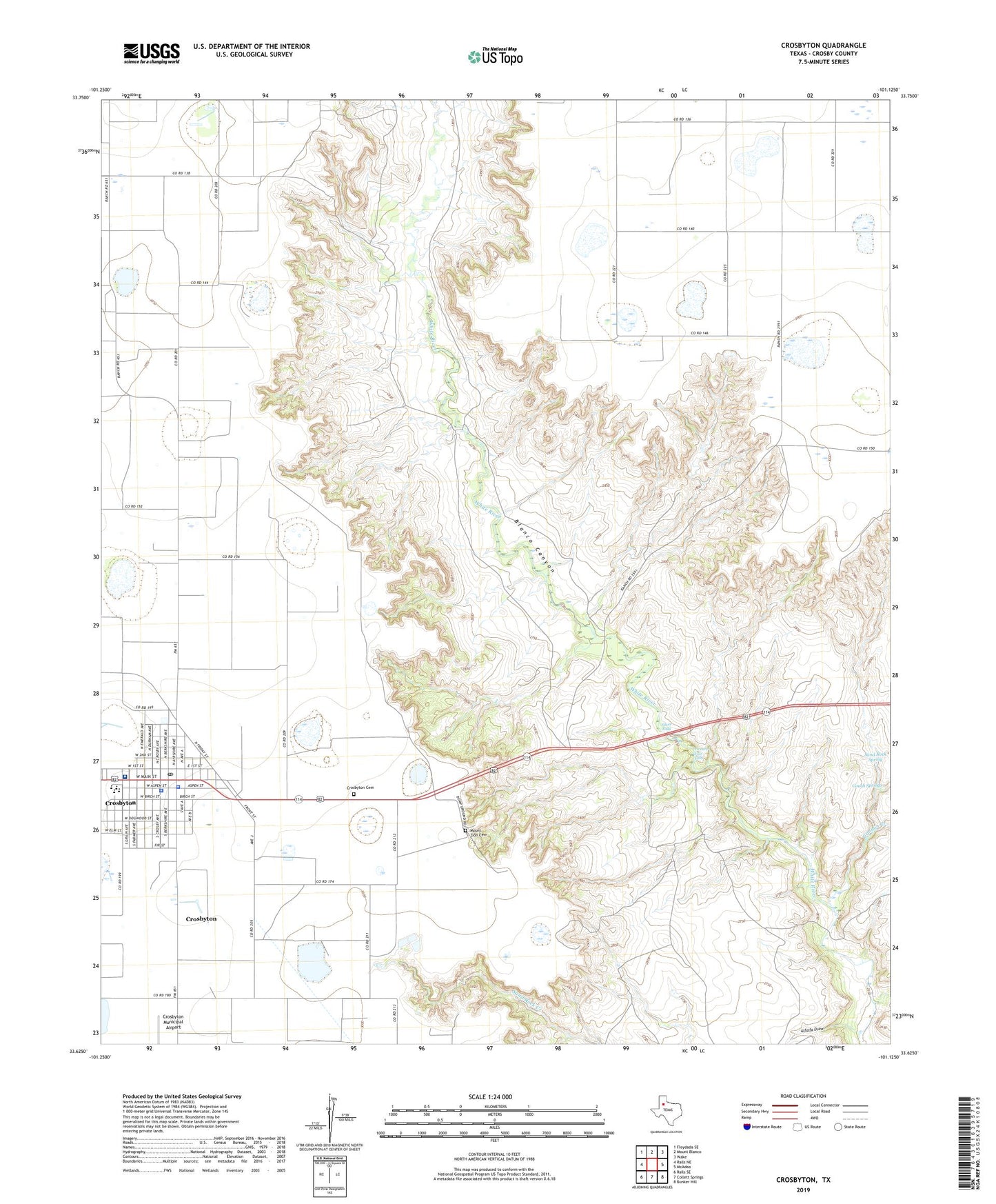
2022 topographic map quadrangle Crosbyton in the state of Texas. Scale: 1:24000. Based on the newly updated USGS 7.5' US Topo map series, this map is in the following counties: Crosby. The map contains contour data, water features, and other items you are used to seeing on USGS maps, but also has updated roads and other features. This is the next generation of topographic maps. Printed on high-quality waterproof paper with UV fade-resistant inks.
Quads adjacent to this one:
West: Ralls NE
Northwest: Floydada SE
North: Mount Blanco
Northeast: Wake
East: McAdoo
Southeast: Bunker Hill
South: Collett Springs
Southwest: Ralls SE
This map covers the same area as the classic USGS quad with code o33101f2.
Contains the following named places: Alfalfa Draw, Blanco Canyon, Camp Rio Blanco, Church of Christ, City of Crosbyton, Couch Springs, Crosby County Constable's Office, Crosby County Pioneer Memorial Museum, Crosby County Sheriff's Office, Crosbyton, Crosbyton Cemetery, Crosbyton City Hall, Crosbyton Clinic Hospital, Crosbyton Division, Crosbyton Elementary School, Crosbyton High School, Crosbyton Middle School, Crosbyton Police Department, Crosbyton Post Office, Galilee Baptist Church, Gannon Creek, Mount Zion Cemetery, Sand Rock Spring, Silver Falls, Special Education Co - Op School, Twenty Foot Falls, ZIP Code: 79322