MyTopo
Croton Camp Texas US Topo Map
Couldn't load pickup availability
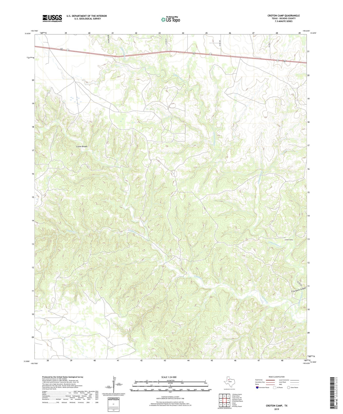
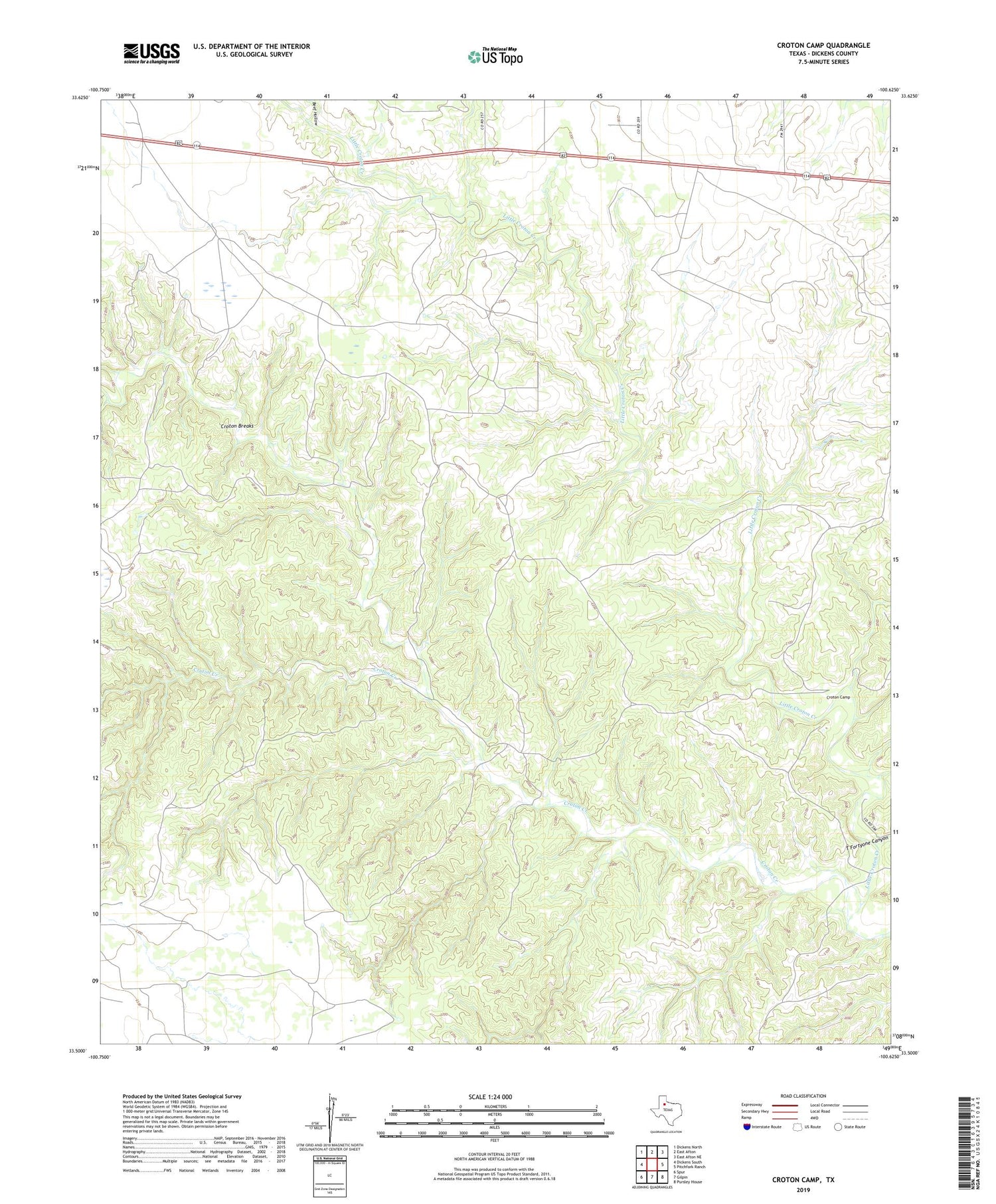
2019 topographic map quadrangle Croton Camp in the state of Texas. Scale: 1:24000. Based on the newly updated USGS 7.5' US Topo map series, this map is in the following counties: Dickens. The map contains contour data, water features, and other items you are used to seeing on USGS maps, but also has updated roads and other features. This is the next generation of topographic maps. Printed on high-quality waterproof paper with UV fade-resistant inks.
Quads adjacent to this one:
West: Dickens South
Northwest: Dickens North
North: East Afton
Northeast: East Afton NE
East: Pitchfork Ranch
Southeast: Pursley House
South: Gilpin
Southwest: Spur
Contains the following named places: Beef Hollow, Croton Breaks, Croton Camp, Dickens Pens Windmill, Floyd Smith Windmill, Humble Windmill, J-2 Creek, J-2 Windmill, Jake Rains Windmill, Little Croton Creek, Little Croton Windmill, Little Sampson Windmill, Lost John Windmill, Middle Croton Windmill, North Pitchfork Corner Windmill, T Fortyone Canyon, Two Sections Windmill, Upper Croton Windmill