MyTopo
Spur Texas US Topo Map
Couldn't load pickup availability
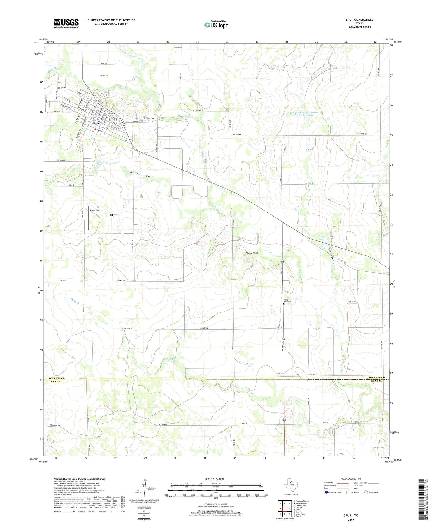
2022 topographic map quadrangle Spur in the state of Texas. Scale: 1:24000. Based on the newly updated USGS 7.5' US Topo map series, this map is in the following counties: Dickens, Kent. The map contains contour data, water features, and other items you are used to seeing on USGS maps, but also has updated roads and other features. This is the next generation of topographic maps. Printed on high-quality waterproof paper with UV fade-resistant inks.
Quads adjacent to this one:
West: Spur NW
Northwest: Foreman Chapel
North: Dickens South
Northeast: Croton Camp
East: Gilpin
Southeast: Girard
South: White Camp
Southwest: Spur SW
This map covers the same area as the classic USGS quad with code o33100d7.
Contains the following named places: Bethel Baptist Church, Camp Creek, City of Spur, Community Bible Chapel Church, Dickens County Ambulance Services Main Office, Dickens County Jail, Dockum, Dockum Creek, First Baptist Church, Soil Conservation Service Site 12 Dam, Soil Conservation Service Site 12 Reservoir, Spade Draw, Spur, Spur Cemetery, Spur City Hall, Spur Division, Spur Police Department, Spur Post Office, Spur School, Spur Volunteer Fire Department, Steele Hill, Steele Hill Cemetery, Steele Hills, Swenson Park, Travis Field, Wilson Draw