MyTopo
Dickens South Texas US Topo Map
Couldn't load pickup availability
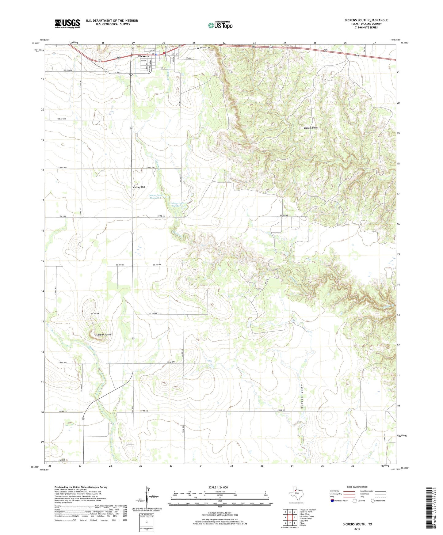
2022 topographic map quadrangle Dickens South in the state of Texas. Scale: 1:24000. Based on the newly updated USGS 7.5' US Topo map series, this map is in the following counties: Dickens. The map contains contour data, water features, and other items you are used to seeing on USGS maps, but also has updated roads and other features. This is the next generation of topographic maps. Printed on high-quality waterproof paper with UV fade-resistant inks.
Quads adjacent to this one:
West: Foreman Chapel
Northwest: Haystack Mountain
North: Dickens North
Northeast: East Afton
East: Croton Camp
Southeast: Gilpin
South: Spur
Southwest: Spur NW
This map covers the same area as the classic USGS quad with code o33100e7.
Contains the following named places: Cathey Hill, City of Dickens, Dickens, Dickens Cemetery, Dickens City Hall, Dickens County, Dickens County Ambulance Service, Dickens County Museum, Dickens County Sheriff's Office, Dickens Post Office, Dickens Volunteer Fire Department, Lehew Dam Number 1, Lehew Dam Number 2, Lehew Lake Number 1, Lehew Lake Number 2, Soldier Mound, Soldiers Mound