MyTopo
Cryer Creek Texas US Topo Map
Couldn't load pickup availability
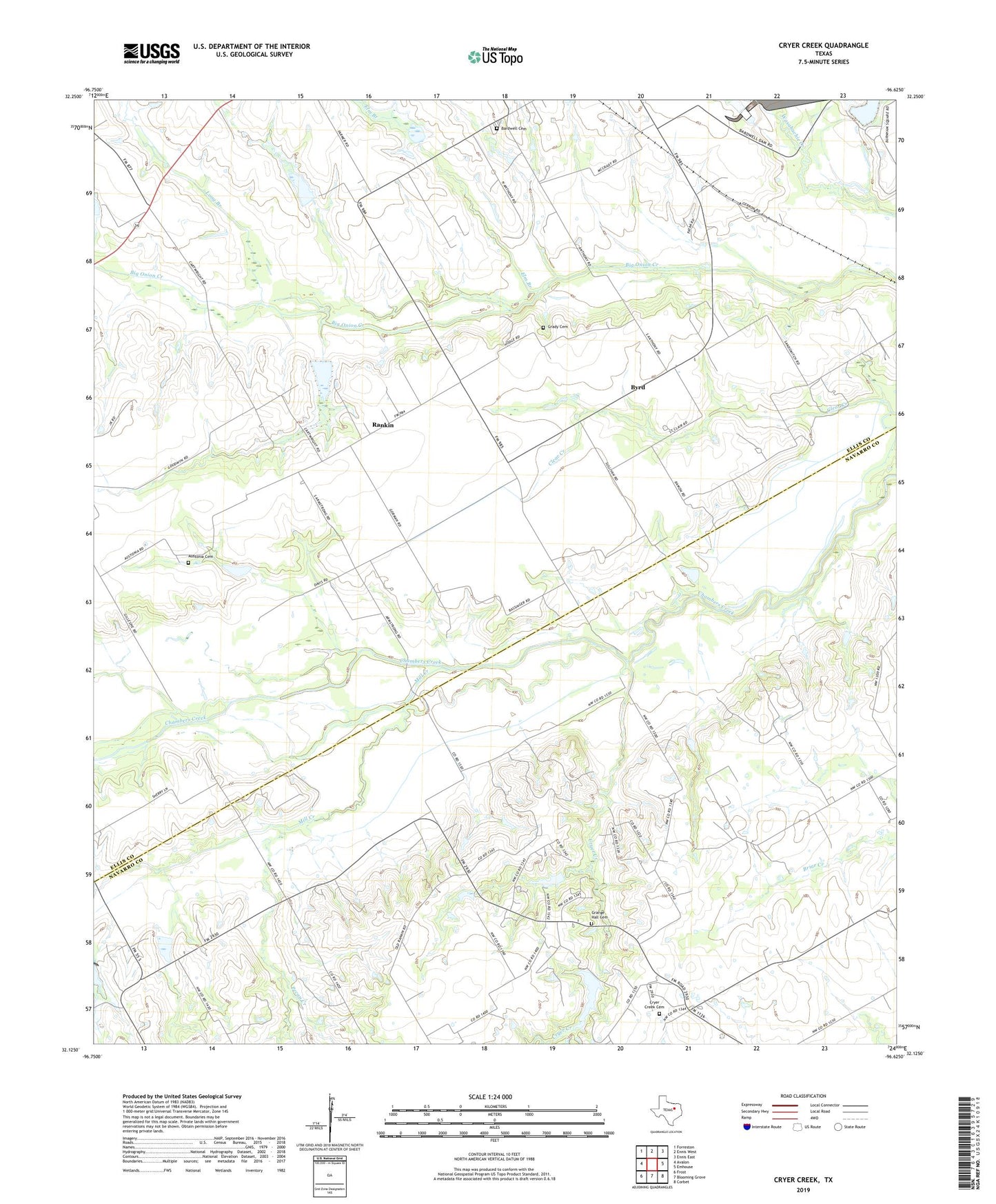
2019 topographic map quadrangle Cryer Creek in the state of Texas. Scale: 1:24000. Based on the newly updated USGS 7.5' US Topo map series, this map is in the following counties: Navarro, Ellis. The map contains contour data, water features, and other items you are used to seeing on USGS maps, but also has updated roads and other features. This is the next generation of topographic maps. Printed on high-quality waterproof paper with UV fade-resistant inks.
Quads adjacent to this one:
West: Avalon
Northwest: Forreston
North: Ennis West
Northeast: Ennis East
East: Emhouse
Southeast: Corbet
South: Blooming Grove
Southwest: Frost
Contains the following named places: Austonia Cemetery, Austonia Church, Bardwell Cemetery, Byrd, Cryer Creek, Cryer Creek Cemetery, Elm Branch, Grady Cemetery, Grange Hall Cemetery, Long Branch, Mill Creek, Mustang Creek, Pecan Creek, Rankin, Soil Conservation Service Site 104a Dam, Soil Conservation Service Site 104a Reservoir, Soil Conservation Service Site 115 Dam, Soil Conservation Service Site 115 Reservoir, Soil Conservation Service Site 116 Dam, Soil Conservation Service Site 116 Reservoir, Soil Conservation Service Site 117 Dam, Soil Conservation Service Site 117 Reservoir, Soil Conservation Service Site 119a Dam, Soil Conservation Service Site 119a Reservoir, Soil Conservation Service Site 119b Dam, Soil Conservation Service Site 119b Reservoir, Soil Conservation Service Site 29 Dam, Soil Conservation Service Site 29 Reservoir, Soil Conservation Service Site 95 Dam, Soil Conservation Service Site 95 Reservoir, Tonkawa Trail