MyTopo
Forreston Texas US Topo Map
Couldn't load pickup availability
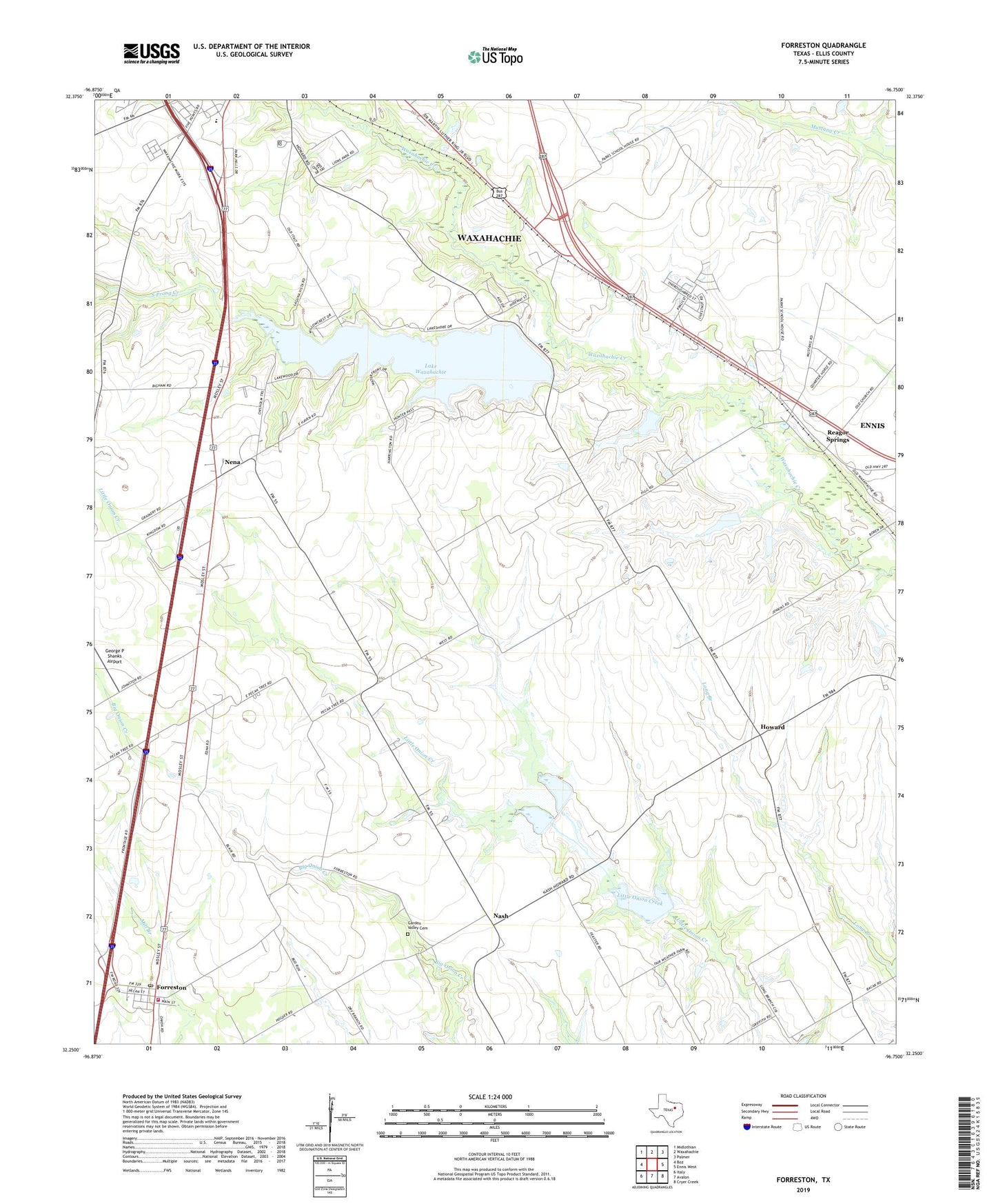
2022 topographic map quadrangle Forreston in the state of Texas. Scale: 1:24000. Based on the newly updated USGS 7.5' US Topo map series, this map is in the following counties: Ellis. The map contains contour data, water features, and other items you are used to seeing on USGS maps, but also has updated roads and other features. This is the next generation of topographic maps. Printed on high-quality waterproof paper with UV fade-resistant inks.
Quads adjacent to this one:
West: Boz
Northwest: Midlothian
North: Waxahachie
Northeast: Palmer
East: Ennis West
Southeast: Cryer Creek
South: Avalon
Southwest: Italy
This map covers the same area as the classic USGS quad with code o32096c7.
Contains the following named places: Dunaway Elementary School, Ellis County, Forreston, Forreston Post Office, Forreston Volunteer Fire Department, Garden Valley Cemetery, George P Shanks Airport, Haven Field, Howard, Lake Waxahachie, Nash, Nelson, Nena, New Birth Community Bible Church, Reagor Springs, Soil Conservation Service Site 111 and 112 Dam, Soil Conservation Service Site 111 and 112 Reservoir, Soil Conservation Service Site 113 Dam, Soil Conservation Service Site 113 Reservoir, Soil Conservation Service Site 23 Dam, Soil Conservation Service Site 23 Reservoir, Soil Conservation Service Site 24 Dam, Soil Conservation Service Site 24 Reservoir, South Prong Baptist Church, South Prong Creek, South Prong Dam, Spring Park, Waxahachie Division, ZIP Code: 75165