MyTopo
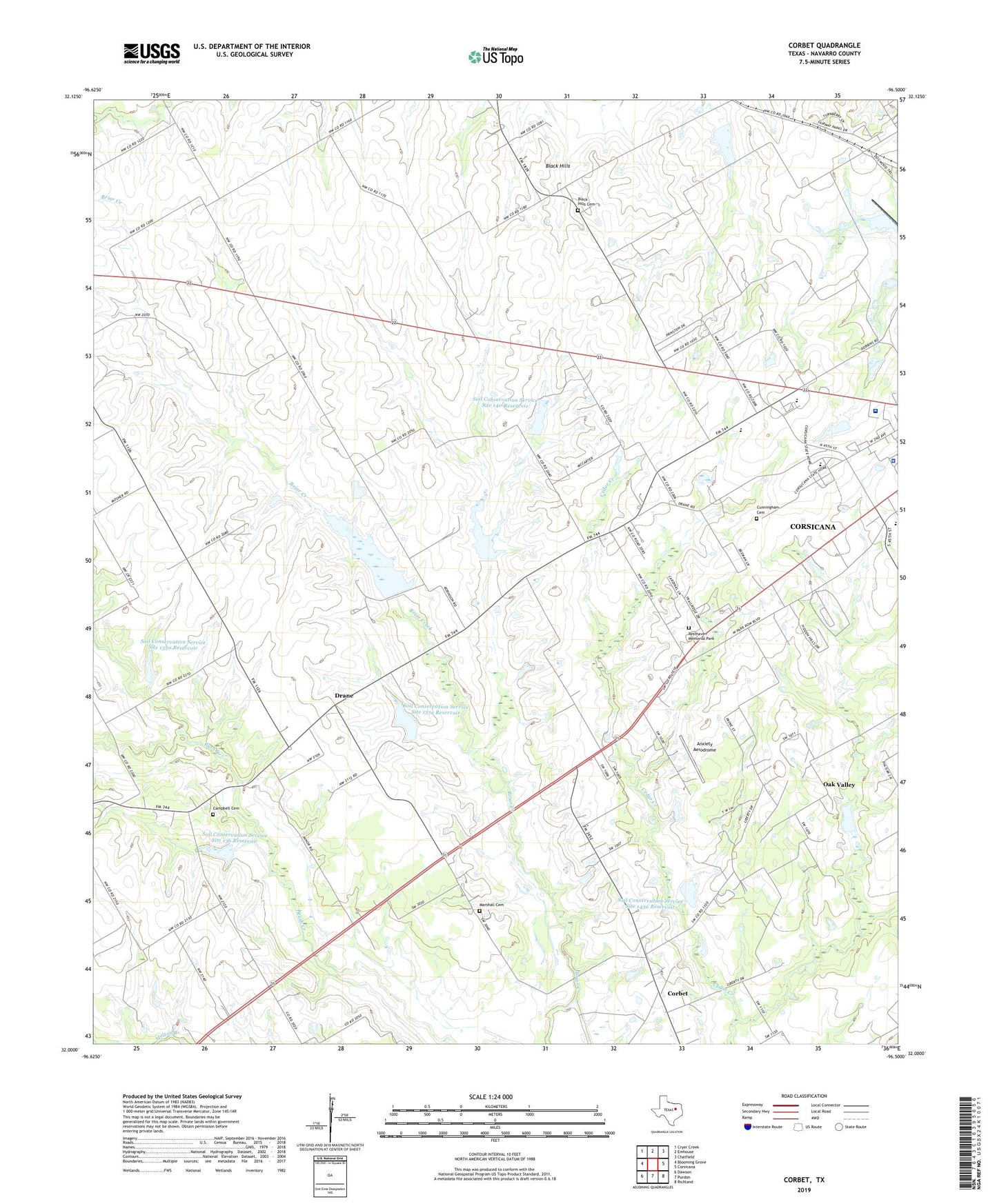
Corbet Texas US Topo Map
Couldn't load pickup availability
2022 topographic map quadrangle Corbet in the state of Texas. Scale: 1:24000. Based on the newly updated USGS 7.5' US Topo map series, this map is in the following counties: Navarro. The map contains contour data, water features, and other items you are used to seeing on USGS maps, but also has updated roads and other features. This is the next generation of topographic maps. Printed on high-quality waterproof paper with UV fade-resistant inks.
Quads adjacent to this one:
West: Blooming Grove
Northwest: Cryer Creek
North: Emhouse
Northeast: Chatfield
East: Corsicana
Southeast: Richland
South: Purdon
Southwest: Dawson
This map covers the same area as the classic USGS quad with code o32096a5.
Contains the following named places: Alpha Learning Center, Anxiety Aerodrome, Black Hills, Black Hills Cemetery, Campbell Cemetery, Corbet, Corsicana High School, Cunningham Cemetery, Drane, Marshall Cemetery, Mount Moriah Church, Navarro College Police Department, Navarro Regional Hospital, Oak Valley, Odd Fellows and Rebekah Home for Children, Pleasant Grove United Methodist Church, Resthaven Memorial Park, Soil Conservation Service Site 1350 Dam, Soil Conservation Service Site 1350 Reservoir, Soil Conservation Service Site 136 Dam, Soil Conservation Service Site 136 Reservoir, Soil Conservation Service Site 137a Dam, Soil Conservation Service Site 137a Reservoir, Soil Conservation Service Site 137g Dam, Soil Conservation Service Site 137g Reservoir, Soil Conservation Service Site 138 Dam, Soil Conservation Service Site 138 Reservoir, Soil Conservation Service Site 140 Dam, Soil Conservation Service Site 140 Reservoir, Soil Conservation Service Site 143a Dam, Soil Conservation Service Site 143a Reservoir, Tiger Field, Town of Oak Valley, Whites Chapel, ZIP Code: 75110