MyTopo
Dale Texas US Topo Map
Couldn't load pickup availability
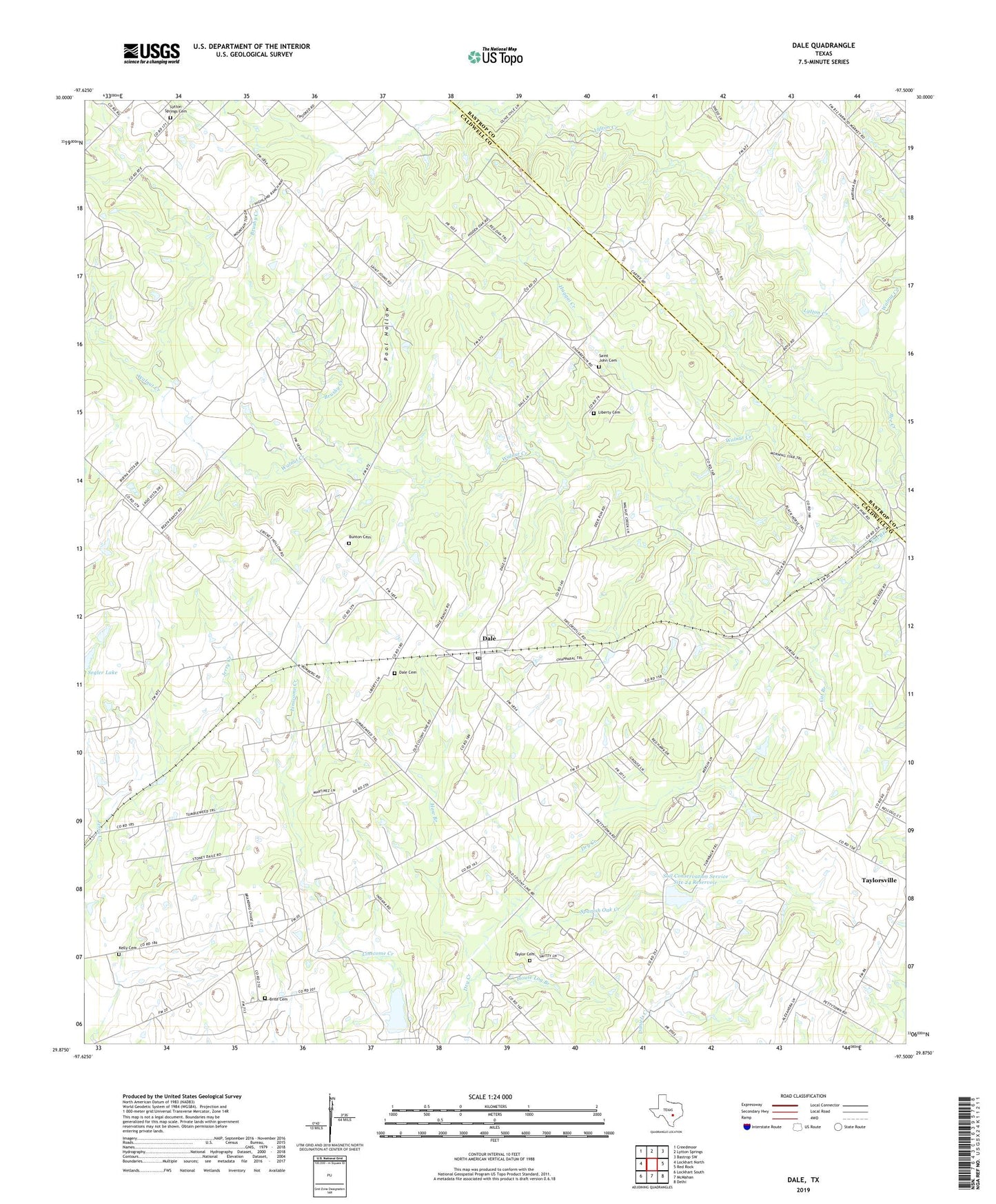
2019 topographic map quadrangle Dale in the state of Texas. Scale: 1:24000. Based on the newly updated USGS 7.5' US Topo map series, this map is in the following counties: Caldwell, Bastrop. The map contains contour data, water features, and other items you are used to seeing on USGS maps, but also has updated roads and other features. This is the next generation of topographic maps. Printed on high-quality waterproof paper with UV fade-resistant inks.
Quads adjacent to this one:
West: Lockhart North
Northwest: Creedmoor
North: Lytton Springs
Northeast: Bastrop SW
East: Red Rock
Southeast: Delhi
South: McMahan
Southwest: Lockhart South
Contains the following named places: Bee Creek, Brite Cemetery, Brushy Creek, Buchanan Oil Field, Bunton Cemetery, Cat Branch, Dale, Dale Cemetery, Dale Oil Field, Dale Post Office, Haggai Creek, Haw Branch, House Log Branch, Kelly Cemetery, Liberty Cemetery, Lytton Creek, Lytton Springs Cemetery, Lytton Springs Oil Field, Pool Hollow, Saint John Cemetery, Saint Johns Colony, Saint Lytton School, Segler Lake, Soil Conservation Service Site 24 Dam, Soil Conservation Service Site 24 Reservoir, Soil Conservation Service Site 26 Dam, Soil Conservation Service Site 26 Reservoir, Spanish Oak Creek, Taylor Cemetery, Zion Church, ZIP Code: 78616