
MyTopo
Deadmans Hill Texas US Topo Map
Couldn't load pickup availability
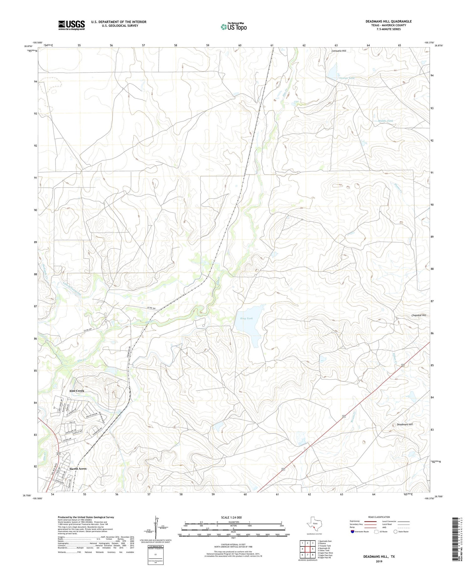
2019 topographic map quadrangle Deadmans Hill in the state of Texas. Scale: 1:24000. Based on the newly updated USGS 7.5' US Topo map series, this map is in the following counties: Maverick. The map contains contour data, water features, and other items you are used to seeing on USGS maps, but also has updated roads and other features. This is the next generation of topographic maps. Printed on high-quality waterproof paper with UV fade-resistant inks.
Quads adjacent to this one:
West: Quemado SE
Northwest: Quemado East
North: Paloma
Northeast: Trosado Tank
East: Indian Tank
Southeast: Eagle Pass NE
South: Eagle Pass East
Southwest: Eagle Pass West
Contains the following named places: Chapotal Hill, Consuelo Hill, Deadmans Hill, Deer Run Number 1 Colonia, Deer Run Number 2 Colonia, Deer Run Number 3 Colonia, Deer Run Number 4 Colonia, Deer Run Number 5 Colonia, Elm Creek, Elm Creek Census Designated Place, George Tank, Hediondo Creek, Kincaid Lake Number 2, Kincaid Lake Number 2 Dam, King Tank, King Tank Dam, Lateral Twentyone, Mangum Lake Number 2 Dam, Middle Tank, Paula Tank, Paula Tank Dam, Sauz Creek Colonia, Siesta Acres, Siesta Acres Census Designated Place, South Elm Creek Number 1 Colonia, South Elm Creek Number 2 Colonia, South Elm Creek Number 3 Colonia, South Elm Creek Number 4 Colonia, Taylor Lake, Taylor Lake Dam


