MyTopo
Quemado East Texas US Topo Map
Couldn't load pickup availability
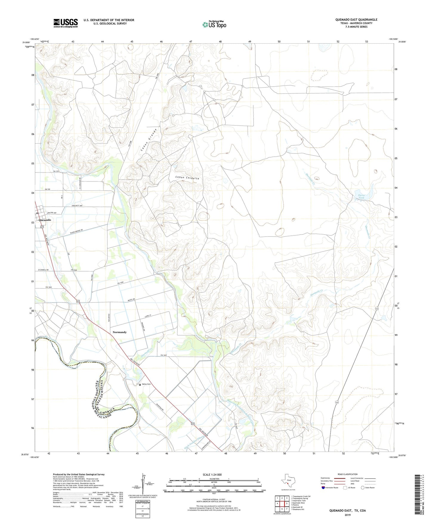
2022 topographic map quadrangle Quemado East in the state of Texas. Scale: 1:24000. Based on the newly updated USGS 7.5' US Topo map series, this map is in the following counties: Maverick. The map contains contour data, water features, and other items you are used to seeing on USGS maps, but also has updated roads and other features. This is the next generation of topographic maps. Printed on high-quality waterproof paper with UV fade-resistant inks.
Quads adjacent to this one:
West: Quemado West
Northwest: Tequesquite Creek SW
North: Tequesquite Spring
Northeast: Imperialist Tank
East: Paloma
Southeast: Deadmans Hill
South: Quemado SE
This map covers the same area as the classic USGS quad with code o28100h5.
Contains the following named places: Canon Chiquita, Canon Grande, Lowrance Lake Dam, Normandy, Normandy Census Designated Place, Parra Tank, Quemado, Quemado Census Designated Place, Quemado Creek, Quemado Post Office, Valley Cemetery, ZIP Code: 78877