MyTopo
Deport Texas US Topo Map
Couldn't load pickup availability
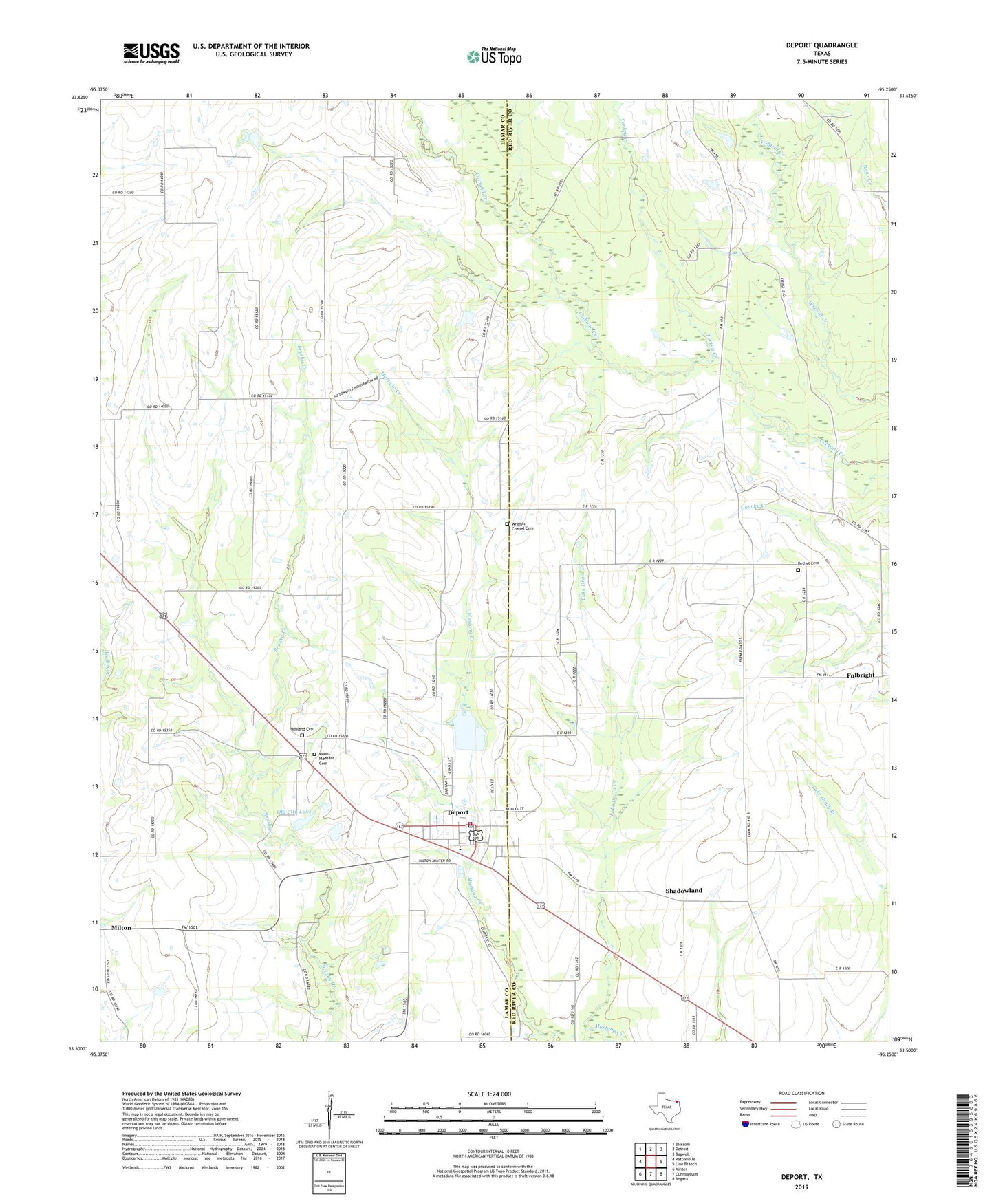
2019 topographic map quadrangle Deport in the state of Texas. Scale: 1:24000. Based on the newly updated USGS 7.5' US Topo map series, this map is in the following counties: Lamar, Red River. The map contains contour data, water features, and other items you are used to seeing on USGS maps, but also has updated roads and other features. This is the next generation of topographic maps. Printed on high-quality waterproof paper with UV fade-resistant inks.
Quads adjacent to this one:
West: Pattonville
Northwest: Blossom
North: Detroit
Northeast: Bagwell
East: Line Branch
Southeast: Bogata
South: Cunningham
Southwest: Minter
Contains the following named places: Bethel Cemetery, Birthplace of John N Garner, Birthplace of John Nance Garner, Byrdtown, City of Deport, Deport, Deport Post Office, Deport Volunteer Fire Department, Fulbright, Highland Cemetery, Hoover, Lake Drain Creek, Milton, Mount Pleasant Cemetery, Old City Lake, Old City Lake Dam, Shadowland, Soil Conservation Service Site 1 Dam, Soil Conservation Service Site 1 Reservoir, Turkey Creek, Wrights Chapel Cemetery