MyTopo
Bogata Texas US Topo Map
Couldn't load pickup availability
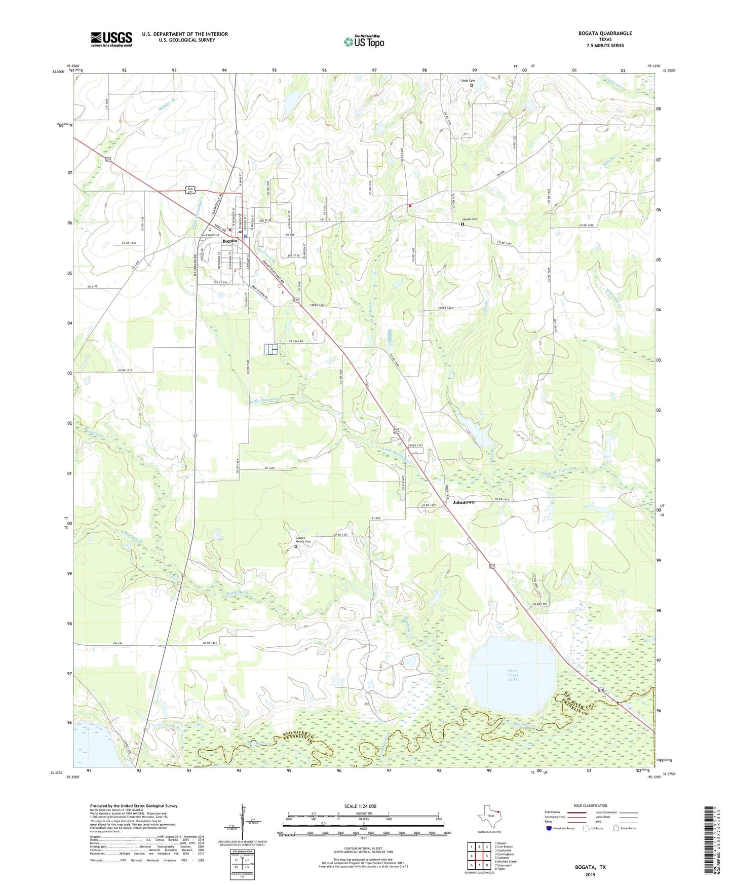
2022 topographic map quadrangle Bogata in the state of Texas. Scale: 1:24000. Based on the newly updated USGS 7.5' US Topo map series, this map is in the following counties: Red River, Franklin, Titus. The map contains contour data, water features, and other items you are used to seeing on USGS maps, but also has updated roads and other features. This is the next generation of topographic maps. Printed on high-quality waterproof paper with UV fade-resistant inks.
Quads adjacent to this one:
West: Cunningham
Northwest: Deport
North: Line Branch
Northeast: Clarksville
East: Cuthand
Southeast: Talco
South: Hagansport
Southwest: Mitchell Creek
This map covers the same area as the classic USGS quad with code o33095d2.
Contains the following named places: Bogata, Bogata Cemetery, Bogata City Hall, Bogata Division, Bogata Fire Department, Bogata Police Department, Bogata Post Office, City of Bogata, Cooper-Woods Cemetery, Dodd Cemetery, Faith Temple Church, Frances Creek, Harvey Estate Dam, Hinson Cemetery, Humble Lake, Johntown, Lake Branch, Morrison Branch, Mustang Creek, River Crest Lake, River Crest Lake Levee, Rosalie, Rosalie Community Center and Volunteer Fire Department, Smith - Rosalie Cemetery, Talco City Pumping Station, White Oak Branch, ZIP Code: 75417