MyTopo
Dime Box Texas US Topo Map
Couldn't load pickup availability
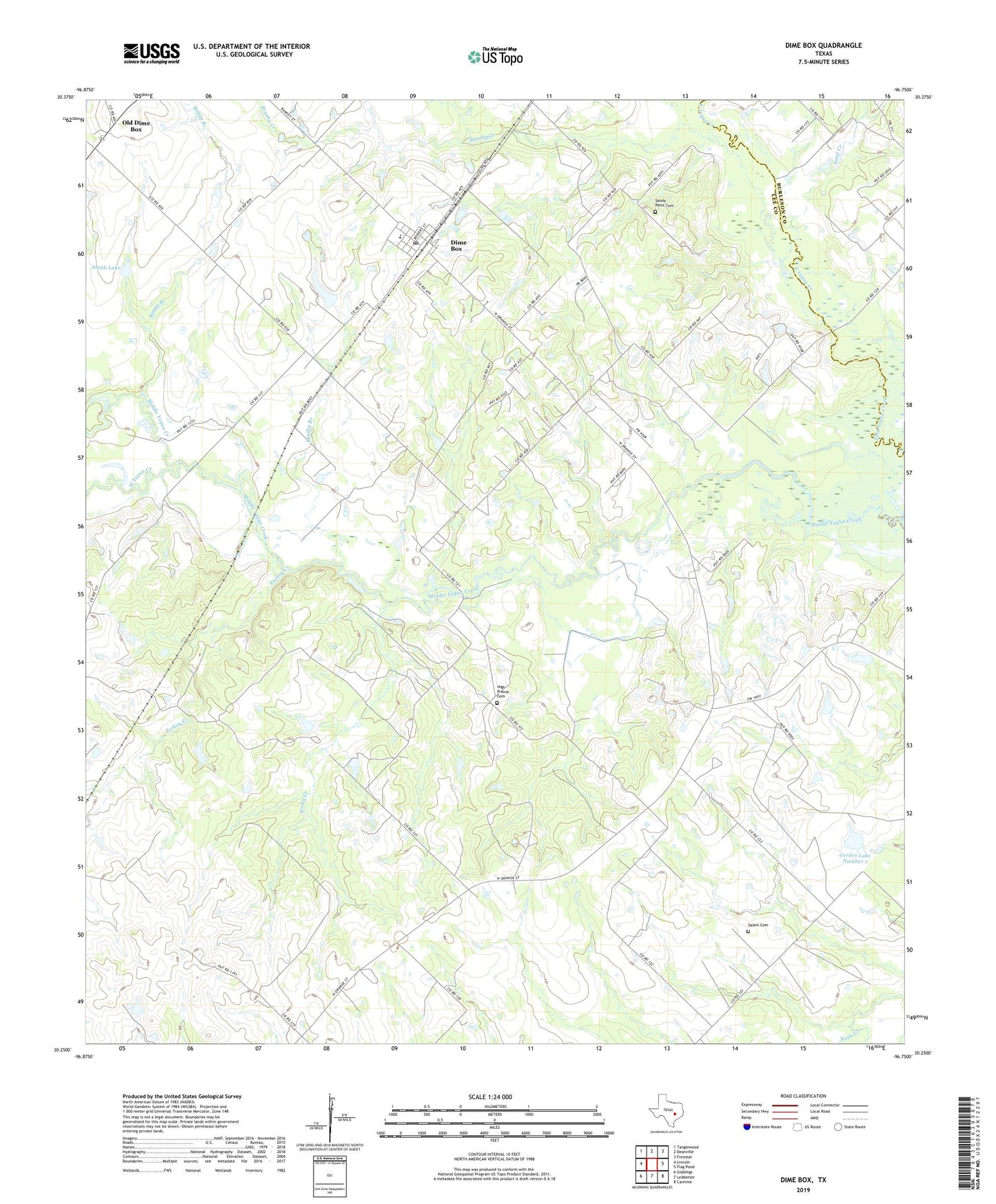
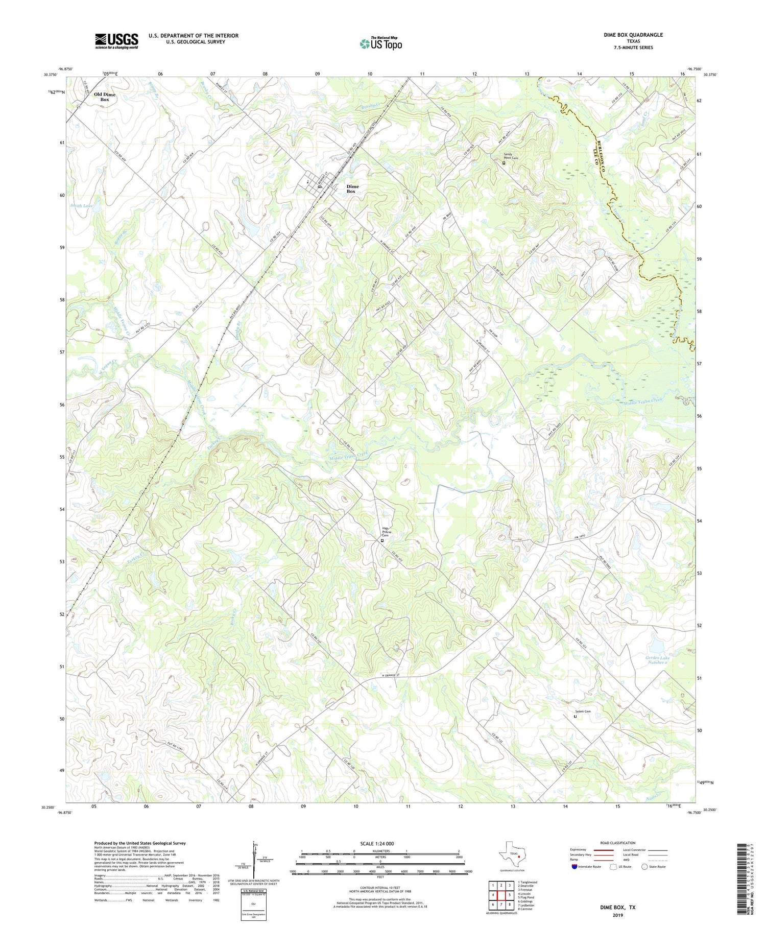
2019 topographic map quadrangle Dime Box in the state of Texas. Scale: 1:24000. Based on the newly updated USGS 7.5' US Topo map series, this map is in the following counties: Lee, Burleson. The map contains contour data, water features, and other items you are used to seeing on USGS maps, but also has updated roads and other features. This is the next generation of topographic maps. Printed on high-quality waterproof paper with UV fade-resistant inks.
Quads adjacent to this one:
West: Lincoln
Northwest: Tanglewood
North: Deanville
Northeast: Frenstat
East: Flag Pond
Southeast: Carmine
South: Ledbetter
Southwest: Giddings
Contains the following named places: Antioch Church, Beat Five Church, Boggy Branch, Brushy Branch, Brushy Creek, Bush Branch, Dime Box, Dime Box Census Designated Place, Dime Box Post Office, Fairview High School, Gerdes Lake Number 1, Gerdes Lake Number 1 Dam, Goodwill Church, High Prairie Cemetery, Rising Star Church, Rocky Creek, Saint John Church, Saint Joseph Church, Salem Cemetery, Sand Creek, Sandy Point Cemetery, Sandy Point Church, Smith Lake, Smith Lake Dam, Somerville Wildlife Management Area, Sweet Home, Sweet Home High School, Turkey Creek, Vickle Church, West Yegua Creek, ZIP Code: 77853