MyTopo
Lincoln Texas US Topo Map
Couldn't load pickup availability
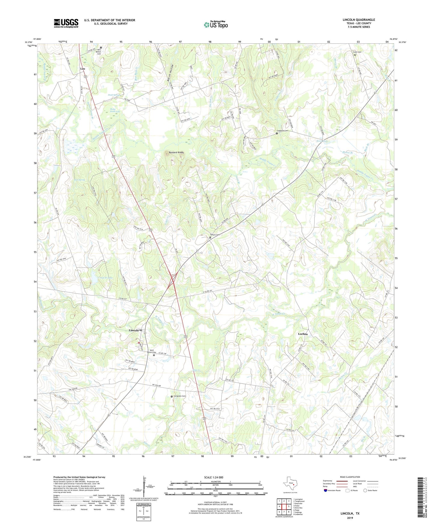
2022 topographic map quadrangle Lincoln in the state of Texas. Scale: 1:24000. Based on the newly updated USGS 7.5' US Topo map series, this map is in the following counties: Lee. The map contains contour data, water features, and other items you are used to seeing on USGS maps, but also has updated roads and other features. This is the next generation of topographic maps. Printed on high-quality waterproof paper with UV fade-resistant inks.
Quads adjacent to this one:
West: Fedor
Northwest: Lexington
North: Tanglewood
Northeast: Deanville
East: Dime Box
Southeast: Ledbetter
South: Giddings
Southwest: Paige
This map covers the same area as the classic USGS quad with code o30096c8.
Contains the following named places: Blue Buck Creek, Buzzard Knobs, C and H Lake, C and H Lake Dam, Cedar Creek, Christ Church, Copperas Cemetery, Copperas Creek, Doak Spring Branch, Doak Spring School, Doak Springs, Elm Creek, Evergreen Cemetery, Field Branch, Gloyna Cemetery, Gum Spring, Indian Camp Branch, Knox Lake, Lee County, Leo, Lincoln, Lincoln Post Office, Lincoln Volunteer Fire Department, Lincoln-Dime Box Division, Loebau, Loebau Siding, Marsh Hollow, Molty Smith Lake, Moore Branch, Mount Olive Church, New Bethel Cemetery, New Bethel Church, Pin Oak Creek, Saint James Church, Saint Johns School, Saint Peters Cemetery, Scott Cemetery, Smith Chapel, The Colony Public Library, Warsaw Branch, Wimberry Lake, ZIP Code: 78948