MyTopo
Dinero Texas US Topo Map
Couldn't load pickup availability
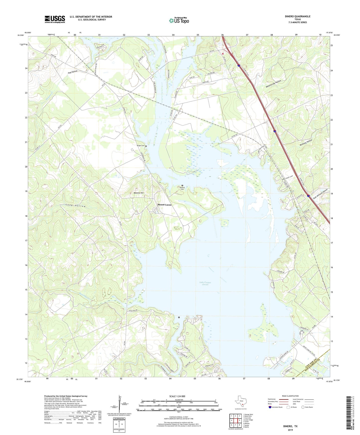
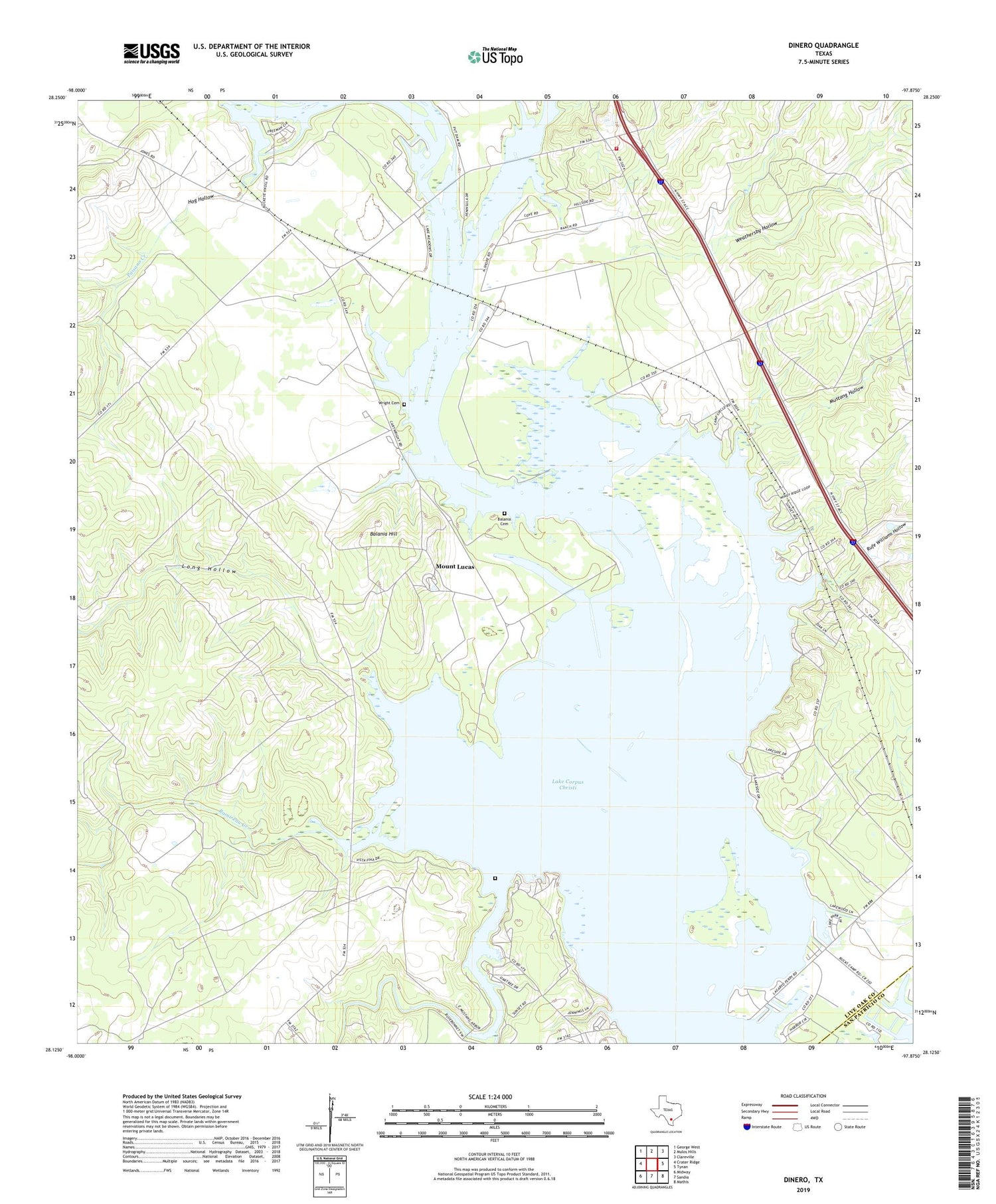
2019 topographic map quadrangle Dinero in the state of Texas. Scale: 1:24000. Based on the newly updated USGS 7.5' US Topo map series, this map is in the following counties: Live Oak, San Patricio. The map contains contour data, water features, and other items you are used to seeing on USGS maps, but also has updated roads and other features. This is the next generation of topographic maps. Printed on high-quality waterproof paper with UV fade-resistant inks.
Quads adjacent to this one:
West: Crater Ridge
Northwest: George West
North: Mulos Hills
Northeast: Clareville
East: Tynan
Southeast: Mathis
South: Sandia
Southwest: Midway
Contains the following named places: Balania Cemetery, Balania Hill, Dinero, Hideaway Hill, Hog Hollow, Lagarto Cemetery, Lagarto Creek, Lake Corpus Christi, Lake Mathis Point Colonia, Long Hollow, Los Lomas, Mount Lucas, Mustang Hollow, North Lakeshore Gardens Colonia, Paisano Creek, Peace Valley Harbor, Ramirena Creek, Rufe Williams Hollow, Swinney Switch, Swinney Switch Volunteer Fire Department, Twin Oaks Ranch, Weathersby Hollow, Wright Cemetery