MyTopo
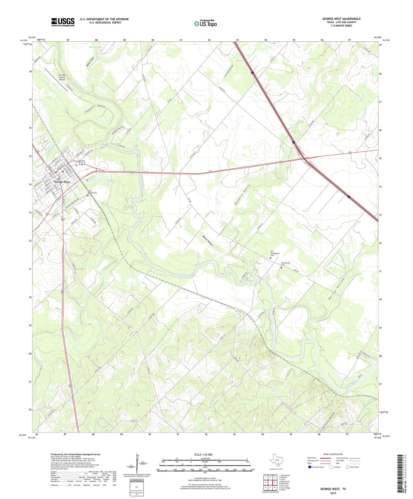
George West Texas US Topo Map
Couldn't load pickup availability
2022 topographic map quadrangle George West in the state of Texas. Scale: 1:24000. Based on the newly updated USGS 7.5' US Topo map series, this map is in the following counties: Live Oak. The map contains contour data, water features, and other items you are used to seeing on USGS maps, but also has updated roads and other features. This is the next generation of topographic maps. Printed on high-quality waterproof paper with UV fade-resistant inks.
Quads adjacent to this one:
West: Oakville SW
Northwest: Three Rivers
North: Oakville
Northeast: Cadiz
East: Mulos Hills
Southeast: Dinero
South: Crater Ridge
Southwest: Elm Creek
This map covers the same area as the classic USGS quad with code o28098c1.
Contains the following named places: City of George West, Gamble Gully, George West, George West Elementary School, George West Fire Department, George West High School, George West Junior High School, George West Police Department, George West Post Office, George West Primary School, Gerhard Hollow, Gilden Creek, Gussettville Cemetery, Hailey Hollow, Harris Dam, Harris Lake, Little Gamble Gully, Live Oak County, Live Oak County Airport, Live Oak County Jail, Live Oak County Sheriff's Office, Live Oak County Station 1, McKimzey Creek, Mikeska, Old Gussettville Cemetery, Ramie Hollow, River Creek Acres, Saint George Cemetery, Spring Creek, Timon Creek, Waller Gully