MyTopo
Tynan Texas US Topo Map
Couldn't load pickup availability
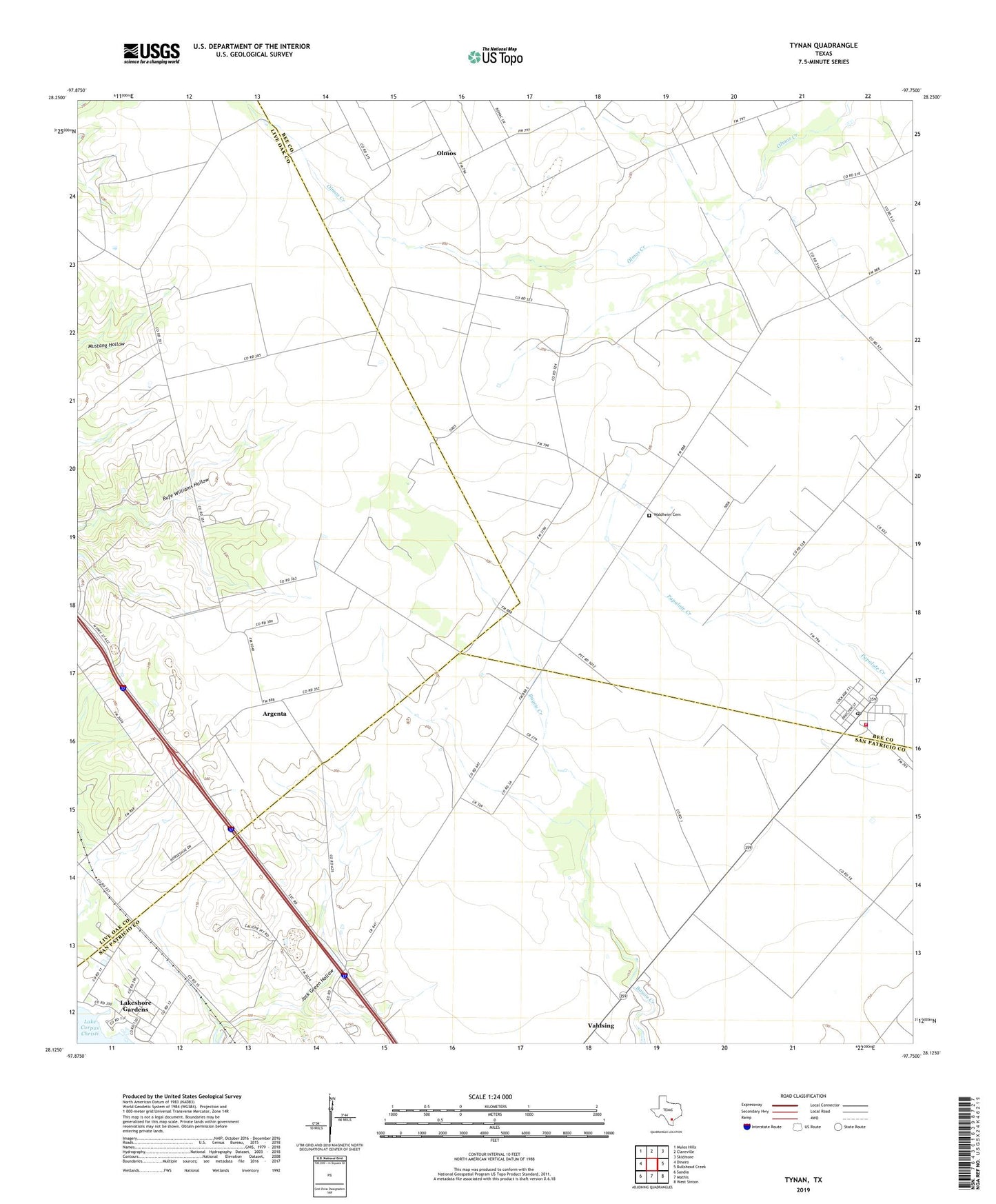
2022 topographic map quadrangle Tynan in the state of Texas. Scale: 1:24000. Based on the newly updated USGS 7.5' US Topo map series, this map is in the following counties: Bee, San Patricio, Live Oak. The map contains contour data, water features, and other items you are used to seeing on USGS maps, but also has updated roads and other features. This is the next generation of topographic maps. Printed on high-quality waterproof paper with UV fade-resistant inks.
Quads adjacent to this one:
West: Dinero
Northwest: Mulos Hills
North: Clareville
Northeast: Skidmore
East: Bullshead Creek
Southeast: West Sinton
South: Mathis
Southwest: Sandia
This map covers the same area as the classic USGS quad with code o28097b7.
Contains the following named places: Argenta, Heldnfelt, Lakeshore Gardens, Lakeshore Gardens Number 1 Colonia, Lakeshore Gardens Number 2 Colonia, Olmos, Tynan, Tynan Post Office, Tynan Volunteer Fire Department, Waldheim Cemetery