MyTopo
Edith Texas US Topo Map
Couldn't load pickup availability
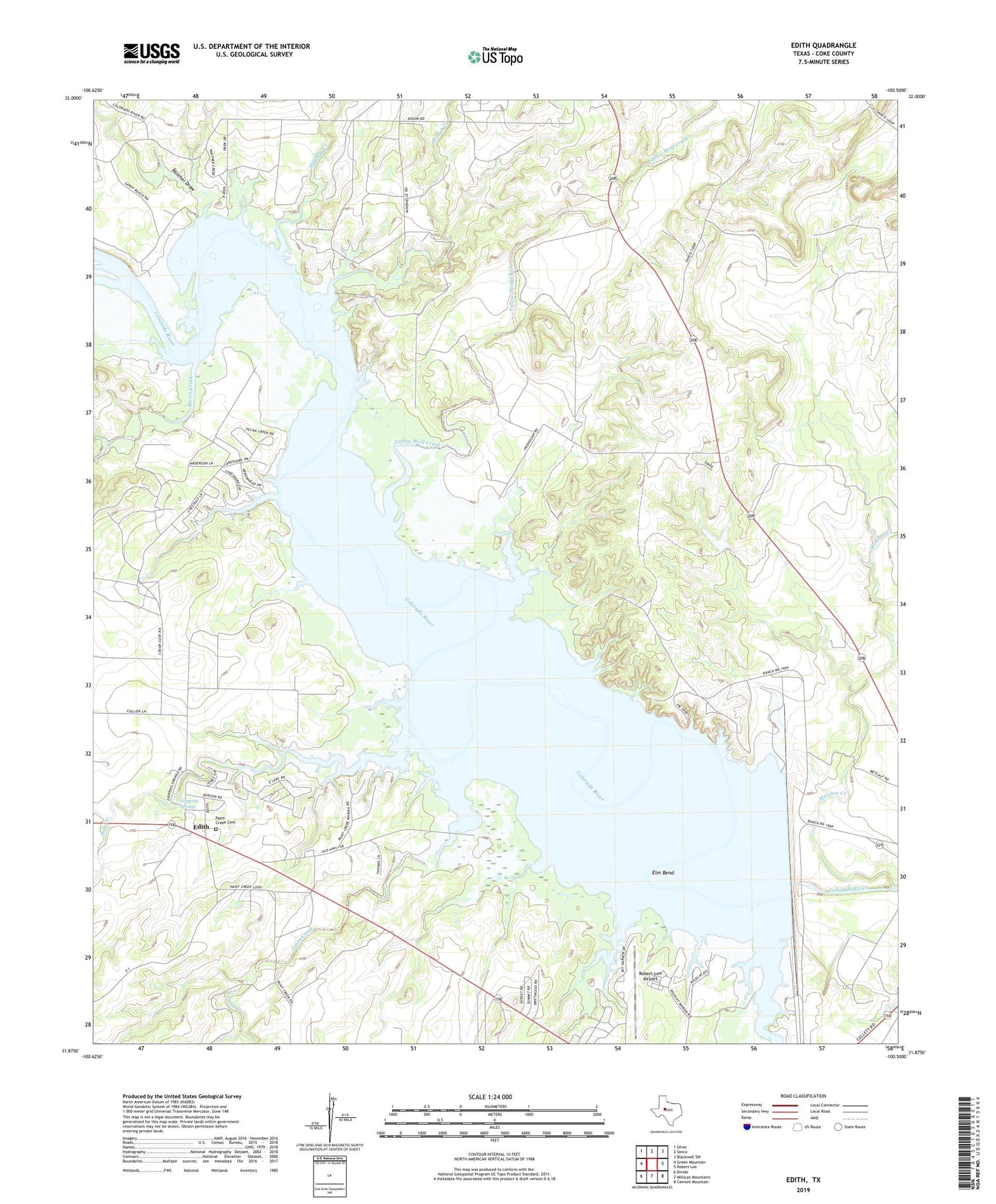
2019 topographic map quadrangle Edith in the state of Texas. Scale: 1:24000. Based on the newly updated USGS 7.5' US Topo map series, this map is in the following counties: Coke. The map contains contour data, water features, and other items you are used to seeing on USGS maps, but also has updated roads and other features. This is the next generation of topographic maps. Printed on high-quality waterproof paper with UV fade-resistant inks.
Quads adjacent to this one:
West: Green Mountain
Northwest: Silver
North: Sanco
Northeast: Blackwell SW
East: Robert Lee
Southeast: Cement Mountain
South: Millican Mountains
Southwest: Divide
Contains the following named places: Coke County, Dripping Springs, Edith, Elm Bend, I A B Oil Field, Lake E V Spence, Lake View Park, Meadow Creek, Paint Creek, Paint Creek Cemetery, Paint Creek Park, Panther Draw, Robert Lee Airport, Robert Lee Dam, Rough Creek, Rough Creek Park, Salt Creek, Sanco Cemetery, Wildcat Creek, Wildcat Creek Park, Yellow Wolf Creek, ZIP Code: 76945