
MyTopo
Edwards Branch Texas US Topo Map
Couldn't load pickup availability
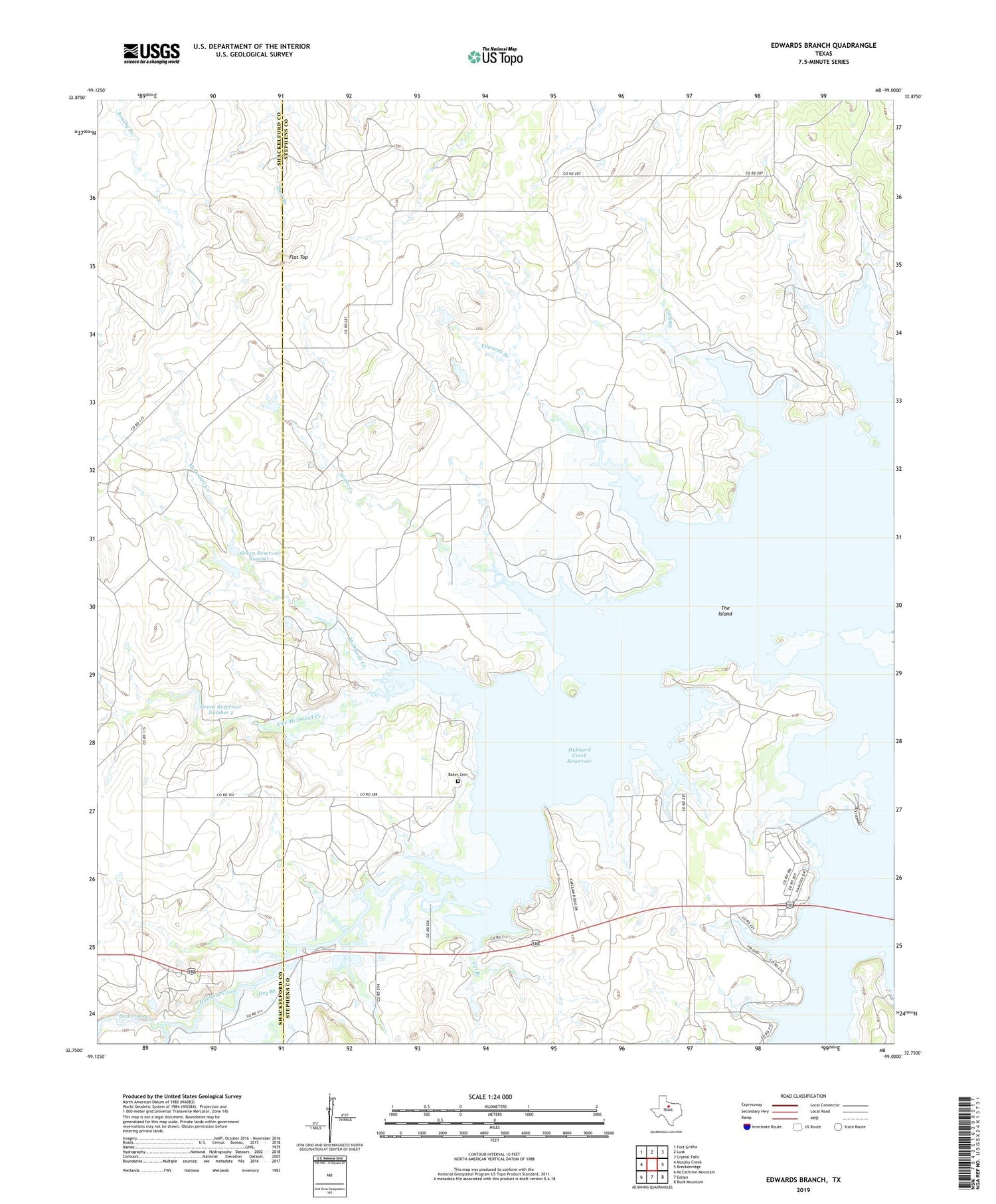
2019 topographic map quadrangle Edwards Branch in the state of Texas. Scale: 1:24000. Based on the newly updated USGS 7.5' US Topo map series, this map is in the following counties: Stephens, Shackelford. The map contains contour data, water features, and other items you are used to seeing on USGS maps, but also has updated roads and other features. This is the next generation of topographic maps. Printed on high-quality waterproof paper with UV fade-resistant inks.
Quads adjacent to this one:
West: Murphy Creek
Northwest: Fort Griffin
North: Lusk
Northeast: Crystal Falls
East: Breckenridge
Southeast: Buck Mountain
South: Eolian
Southwest: McCathrine Mountain
Contains the following named places: Baker Cemetery, Cat Branch, Dry Branch, Edwards Branch, Flat Top, Green Ranch Airport, Green Reservoir Number 1, Green Reservoir Number 1 Dam, Green Reservoir Number 2, Green Reservoir Number 2 Dam, Hubbard Creek Reservoir, McDowell Creek, Negro Creek, Newcomb Creek, South Branch McDowell Creek, The Island


