MyTopo
Eolian Texas US Topo Map
Couldn't load pickup availability
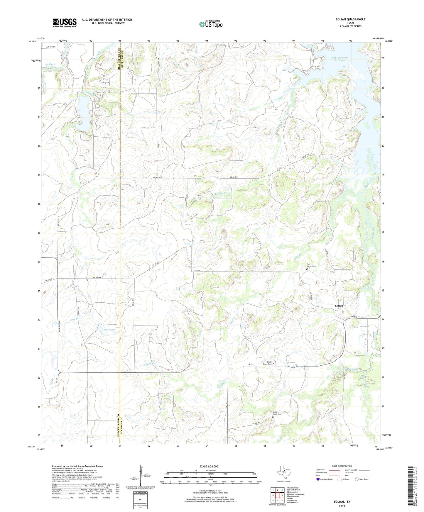
2022 topographic map quadrangle Eolian in the state of Texas. Scale: 1:24000. Based on the newly updated USGS 7.5' US Topo map series, this map is in the following counties: Stephens, Shackelford. The map contains contour data, water features, and other items you are used to seeing on USGS maps, but also has updated roads and other features. This is the next generation of topographic maps. Printed on high-quality waterproof paper with UV fade-resistant inks.
Quads adjacent to this one:
West: McCathrine Mountain
Northwest: Murphy Creek
North: Edwards Branch
Northeast: Breckenridge
East: Buck Mountain
Southeast: Harpersville
South: Indian Knoll
Southwest: Moran
This map covers the same area as the classic USGS quad with code o32099f1.
Contains the following named places: Battle Creek, Battle Creek Cemetery, Bear Branch, Brushy Cemetery, Brushy Creek, De La Fosse Lake, Elliot Lake, Elliot Lake Dam, Eolian, Hog Branch, Ibex Oil Field, Lake de La Fosse Dam, Mankins Mill, Meeks Branch, O'Neal Oil Field, Plum Branch, Plum Branch Cemetery, Shady Grove Cemetery