MyTopo
Buck Mountain Texas US Topo Map
Couldn't load pickup availability
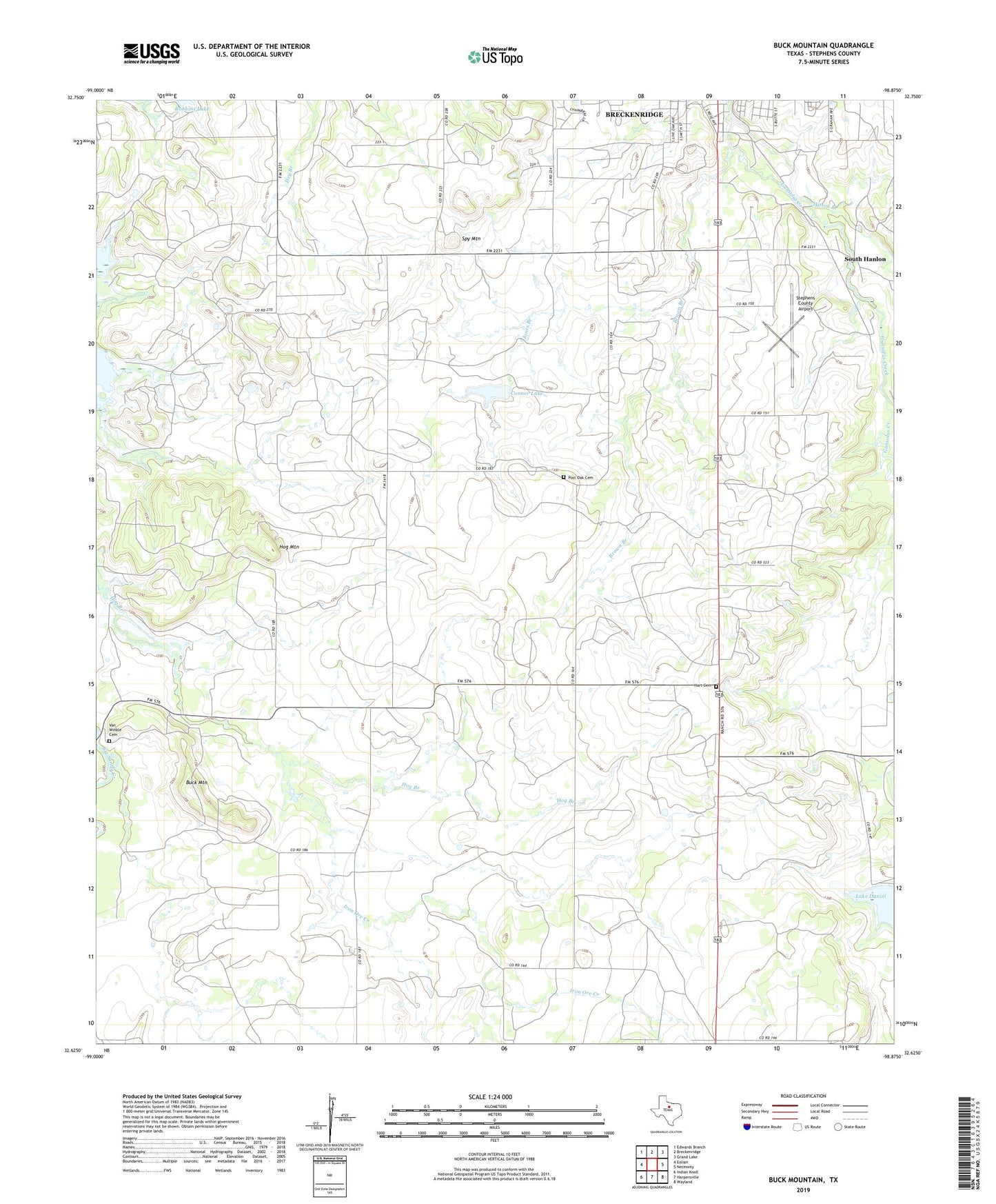
2022 topographic map quadrangle Buck Mountain in the state of Texas. Scale: 1:24000. Based on the newly updated USGS 7.5' US Topo map series, this map is in the following counties: Stephens. The map contains contour data, water features, and other items you are used to seeing on USGS maps, but also has updated roads and other features. This is the next generation of topographic maps. Printed on high-quality waterproof paper with UV fade-resistant inks.
Quads adjacent to this one:
West: Eolian
Northwest: Edwards Branch
North: Breckenridge
Northeast: Grand Lake
East: Necessity
Southeast: Wayland
South: Harpersville
Southwest: Indian Knoll
This map covers the same area as the classic USGS quad with code o32098f8.
Contains the following named places: Breckenridge Oil Field, Brown Branch, Buck Mountain, Buck Mountain Cemetery, Conner Lake, Conner Lake Dam, Curry Oil Field, Hart Cemetery, Hitson Branch, Hog Mountain, Iron Ore Creek, Jones Branch, Museum of Aircraft Perservation, O'Neal Oil Field, Petroleum Corporation of Texas Dam, Petroleum Corporation of Texas Reservoir, Post Oak Cemetery, Robbins Lake Dam, South Hanlon, Spy Mountain, Stephens County Airport, T C Fambro Dam, T C Fambro Reservoir