MyTopo
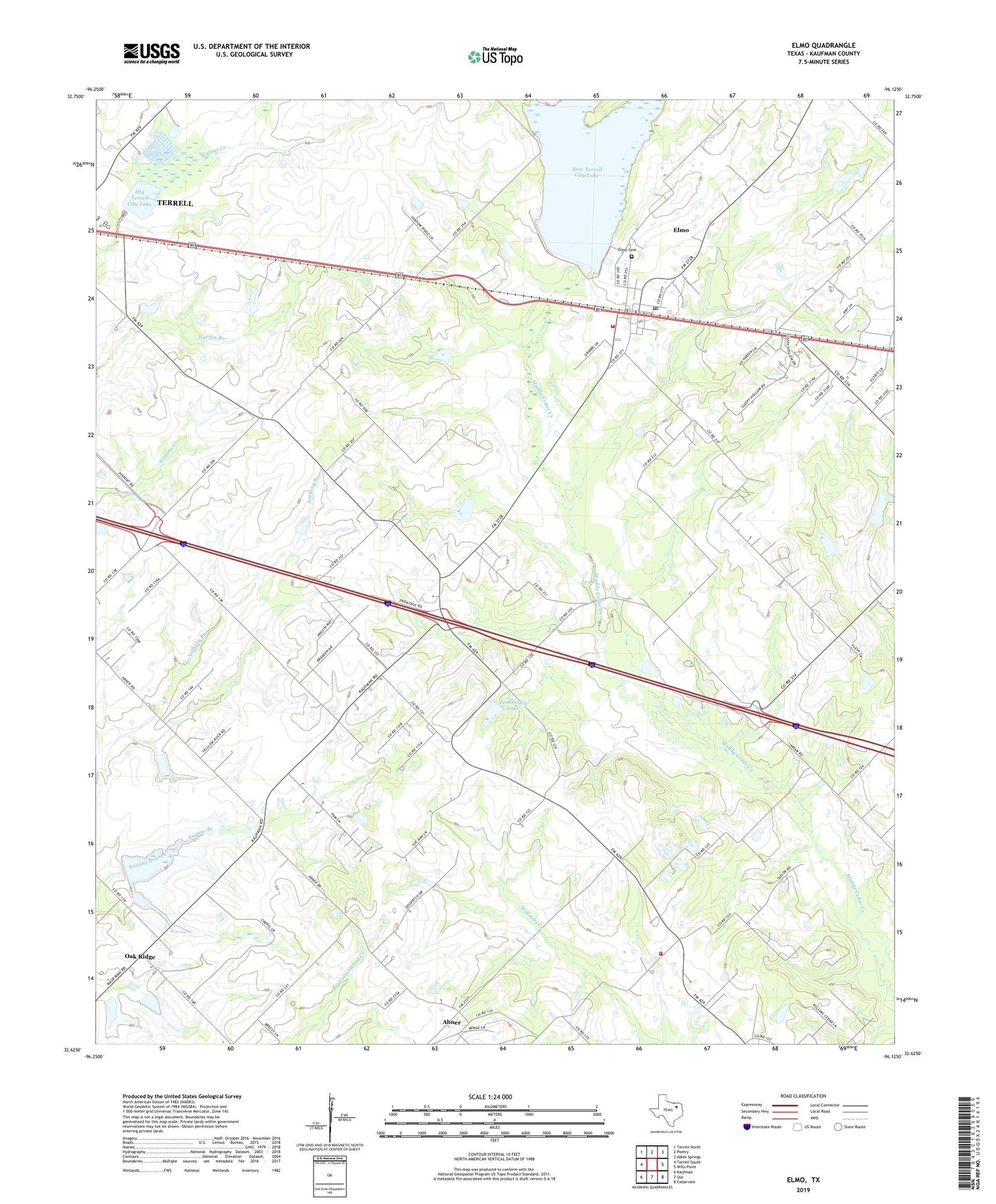
Elmo Texas US Topo Map
Couldn't load pickup availability
2022 topographic map quadrangle Elmo in the state of Texas. Scale: 1:24000. Based on the newly updated USGS 7.5' US Topo map series, this map is in the following counties: Kaufman. The map contains contour data, water features, and other items you are used to seeing on USGS maps, but also has updated roads and other features. This is the next generation of topographic maps. Printed on high-quality waterproof paper with UV fade-resistant inks.
Quads adjacent to this one:
West: Terrell South
Northwest: Terrell North
North: Poetry
Northeast: Ables Springs
East: Wills Point
Southeast: Cedarvale
South: Ola
Southwest: Kaufman
This map covers the same area as the classic USGS quad with code o32096f2.
Contains the following named places: Abner, Black Jack Church, College Mound, College Mound United Methodist Church, College Mound Volunteer Fire Department, Dam Number 57, Dam Number 58, Dam Number 59, Elmo, Elmo Cemetery, Elmo Census Designated Place, Elmo Post Office, Elmo Volunteer Fire Department, Fairview Church, Frog, New Terrell City Lake, Old Terrell City Lake, Shady Grove Church, Soil Conservation Service Site 50c Dam, Soil Conservation Service Site 50c Reservoir, Soil Conservation Service Site 57 Dam, Soil Conservation Service Site 57 Reservoir, Soil Conservation Service Site 58 Dam, Soil Conservation Service Site 58 Reservoir, Soil Conservation Service Site 59 Dam, Soil Conservation Service Site 59 Reservoir, Soil Conservation Service Site 87a Dam, Soil Conservation Service Site 87a Reservoir, Soil Conservation Service Site 88 Dam, Soil Conservation Service Site 88 Reservoir, Soil Conservation Service Site 89 Dam, Soil Conservation Service Site 89 Reservoir, Soil Conservation Service Site 90 Dam, Soil Conservation Service Site 90 Reservoir, Soil Conservation Service Site 94c Dam, Soil Conservation Service Site 94c Reservoir, Tonkersley Lake, Tonkersley Lake Dam, ZIP Code: 75161