MyTopo
Ethel Texas US Topo Map
Couldn't load pickup availability
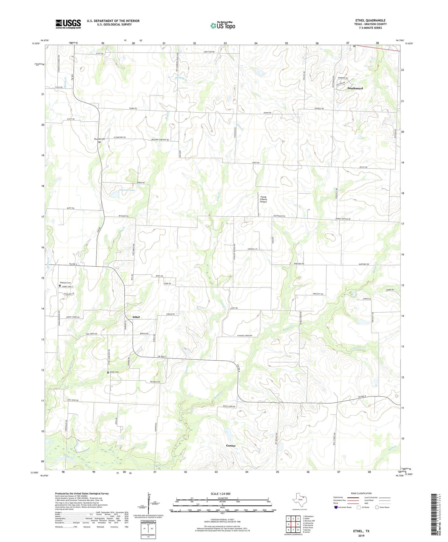
2019 topographic map quadrangle Ethel in the state of Texas. Scale: 1:24000. Based on the newly updated USGS 7.5' US Topo map series, this map is in the following counties: Grayson. The map contains contour data, water features, and other items you are used to seeing on USGS maps, but also has updated roads and other features. This is the next generation of topographic maps. Printed on high-quality waterproof paper with UV fade-resistant inks.
Quads adjacent to this one:
West: Collinsville
Northwest: Whitesboro
North: Sadler
Northeast: Sherman NW
East: Dorchester
Southeast: Gunter
South: Marilee
Southwest: Pilot Point
Contains the following named places: Case Creek, Collinsville Oil Field, Ethel, Ethel Cemetery, Flying S Ranch Airport, Gressett Lake, Gressett Lake Dam, Hester Oil Field, J-Bar Ranch Airport, Little Elm Creek, Mackoy Oil Field, Macomb, Macomb Cemetery, Southmayd Post Office, Southwest Grayson Division, Touchstone Lake, Touchstone Lake Dam, Walthall Cemetery