MyTopo
Marilee Texas US Topo Map
Couldn't load pickup availability
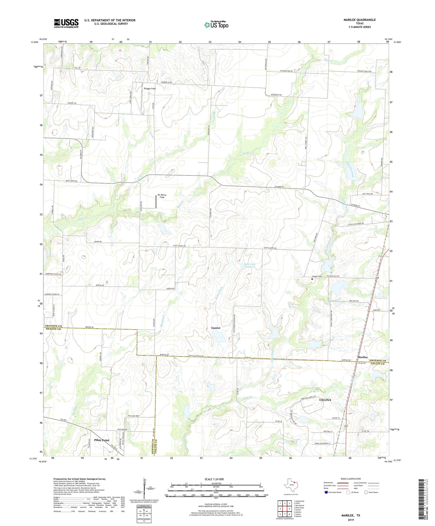
2022 topographic map quadrangle Marilee in the state of Texas. Scale: 1:24000. Based on the newly updated USGS 7.5' US Topo map series, this map is in the following counties: Grayson, Collin, Denton. The map contains contour data, water features, and other items you are used to seeing on USGS maps, but also has updated roads and other features. This is the next generation of topographic maps. Printed on high-quality waterproof paper with UV fade-resistant inks.
Quads adjacent to this one:
West: Pilot Point
Northwest: Collinsville
North: Ethel
Northeast: Dorchester
East: Gunter
Southeast: Weston
South: Celina
Southwest: Aubrey
This map covers the same area as the classic USGS quad with code o33096d7.
Contains the following named places: Bear Creek, Bridges Field, Clarks Branch, Gunter Cemetery, Hunt Lake Number 1, Hunt Lake Number 1 Dam, Hunt Lake Number 2, Hunt Lake Number 2 Dam, Marilee, McManus Field, Mount Carmel Church, Soil Conservation Service Site 1 Dam, Soil Conservation Service Site 1 Reservoir, Soil Conservation Service Site 10 Dam, Soil Conservation Service Site 10 Reservoir, Soil Conservation Service Site 11 Dam, Soil Conservation Service Site 11 Reservoir, Soil Conservation Service Site 12 Dam, Soil Conservation Service Site 12 Reservoir, Soil Conservation Service Site 2 Dam, Soil Conservation Service Site 2 Reservoir, Soil Conservation Service Site 3 Dam, Soil Conservation Service Site 3 Reservoir, Soil Conservation Service Site 4 Dam, Soil Conservation Service Site 4 Reservoir, Soil Conservation Service Site 5 Dam, Soil Conservation Service Site 5 Reservoir, Soil Conservation Service Site 6 Dam, Soil Conservation Service Site 6 Reservoir, Soil Conservation Service Site 7 Dam, Soil Conservation Service Site 7 Reservoir, Soil Conservation Service Site 8b Dam, Soil Conservation Service Site 8b Reservoir, Soil Conservation Service Site 9 Dam, Soil Conservation Service Site 9 Reservoir, Walnut Fork