MyTopo
Fairfield Texas US Topo Map
Couldn't load pickup availability
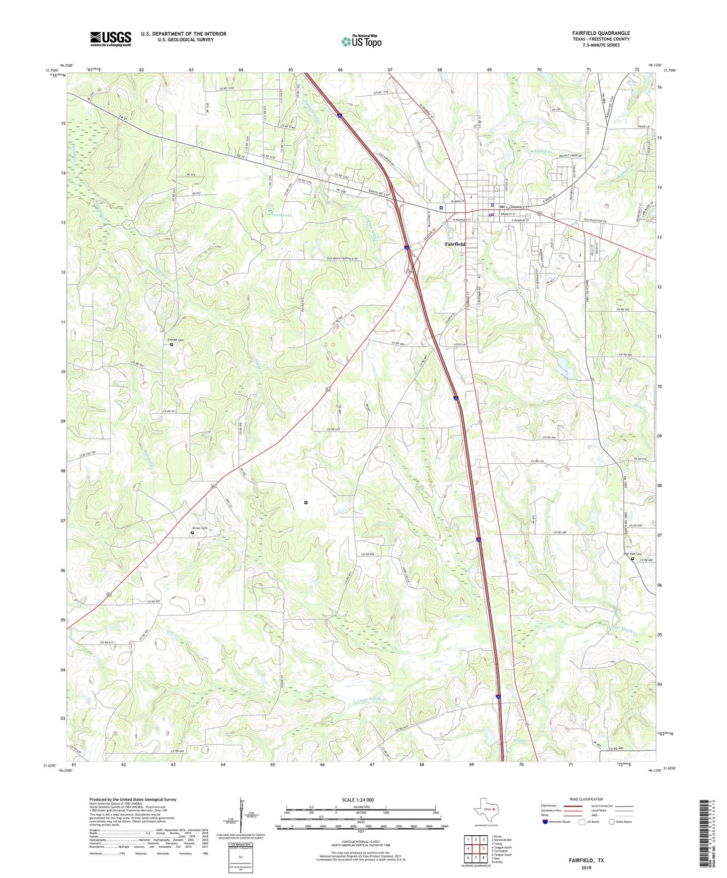
2019 topographic map quadrangle Fairfield in the state of Texas. Scale: 1:24000. Based on the newly updated USGS 7.5' US Topo map series, this map is in the following counties: Freestone. The map contains contour data, water features, and other items you are used to seeing on USGS maps, but also has updated roads and other features. This is the next generation of topographic maps. Printed on high-quality waterproof paper with UV fade-resistant inks.
Quads adjacent to this one:
West: Teague North
Northwest: Kirvin
North: Stewards Mill
Northeast: Young
East: Turlington
Southeast: Lanely
South: Dew
Southwest: Teague South
Contains the following named places: Calvary Baptist Church, City of Fairfield, Clay Hill Church, Dogan Elementary School, Dogan High School, Driver Cemetery, East Texas Medical Center - Fairfield, Fairfield, Fairfield Arena, Fairfield City Hall, Fairfield Elementary School, Fairfield Emergency Medical Service Ambulance, Fairfield Fire Department, Fairfield High School, Fairfield Intermediate School, Fairfield Junior High School, Fairfield Police Department, Fairfield Post Office, Fairfield Volunteer Fire Department, Faith Hope Love Baptist Church, First Baptist Church, Freestone County, Freestone County Constable's Office Precinct 1, Freestone County Constable's Office Precinct 3, Freestone County Historical Museum, Freestone County Jail, Freestone County Sheriff's Office, George Cemetery, Hog Creek, Jehovahs Witnesses Church, Jerusalem Church, KNES-FM (Fairfield), Mount Zion Church, Post Oak Cemetery, Post Oak Church, Round Prairie Baptist Church, Sneed Creek, Sneed Lake, Texas Department of Criminal Justice William R Boyd Unit, Trinity Lutheran Church, Walthall Creek