MyTopo
Kirvin Texas US Topo Map
Couldn't load pickup availability
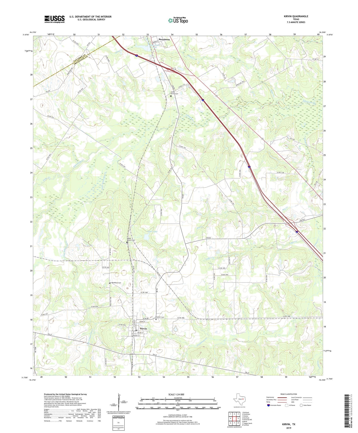
2022 topographic map quadrangle Kirvin in the state of Texas. Scale: 1:24000. Based on the newly updated USGS 7.5' US Topo map series, this map is in the following counties: Freestone, Navarro. The map contains contour data, water features, and other items you are used to seeing on USGS maps, but also has updated roads and other features. This is the next generation of topographic maps. Printed on high-quality waterproof paper with UV fade-resistant inks.
Quads adjacent to this one:
West: Wortham
Northwest: Richland
North: Streetman
Northeast: Winkler
East: Stewards Mill
Southeast: Fairfield
South: Teague North
Southwest: Mexia
This map covers the same area as the classic USGS quad with code o31096g3.
Contains the following named places: Cade Chapel, Caney Church, Cedar Creek, Cedar Grove Cemetery, Dry Creek, Hillery Chapel, Jackson Branch, Kirvin, Kirvin Post Office, Lebanon Church, Little Tehuacana Creek, Loper Lake, Loper Lake Dam, Session Cemetery, Shiloh Church, Sloan Creek, Streetman Lake, Streetman Lake Dam, Tehuacana Grove Church, Town of Kirvin, Webb-Branch Cemetery, White Rock Creek, Woodland Cemetery, Wortham Division, ZIP Code: 75848