MyTopo
Faysville Texas US Topo Map
Couldn't load pickup availability
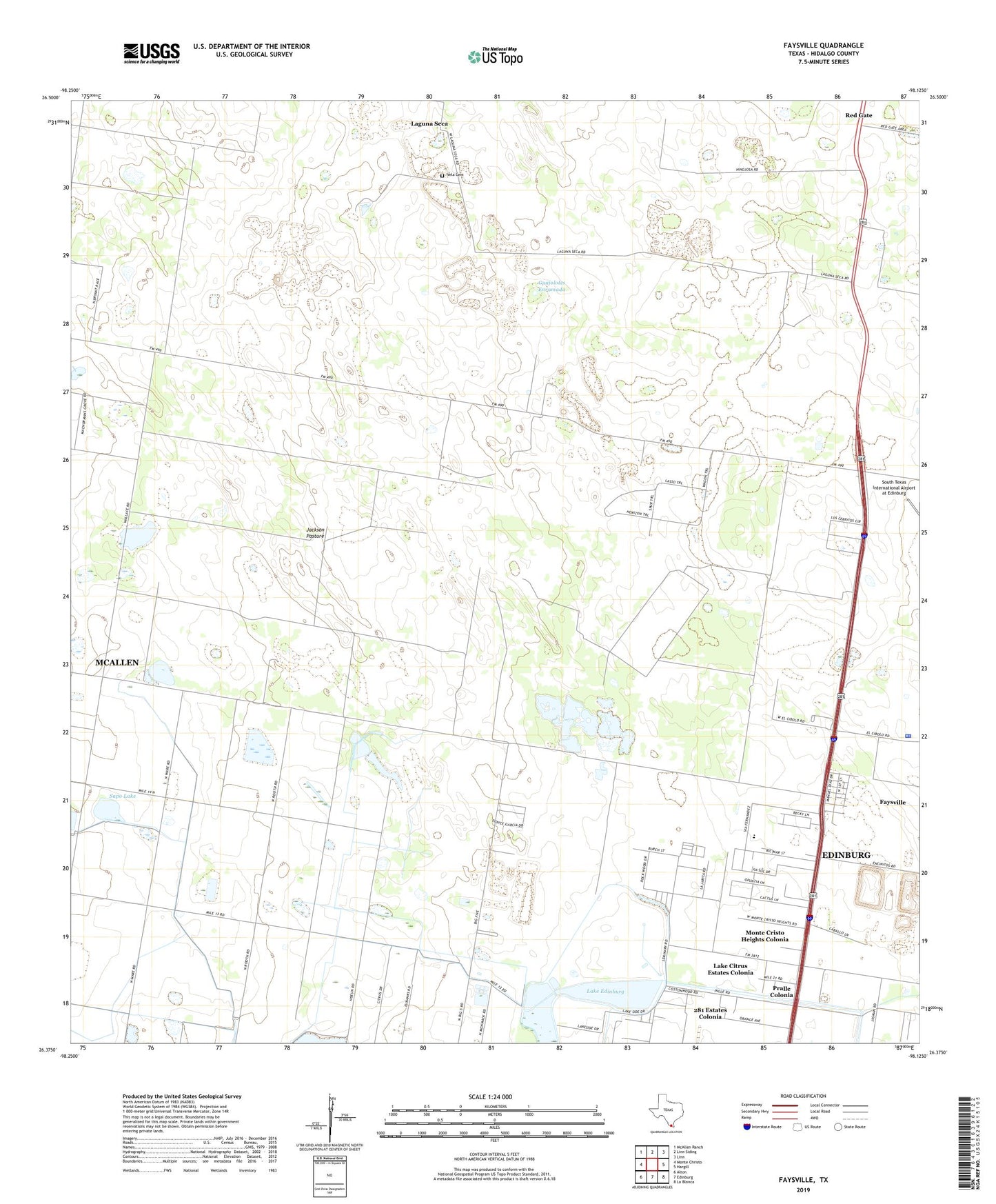
2019 topographic map quadrangle Faysville in the state of Texas. Scale: 1:24000. Based on the newly updated USGS 7.5' US Topo map series, this map is in the following counties: Hidalgo. The map contains contour data, water features, and other items you are used to seeing on USGS maps, but also has updated roads and other features. This is the next generation of topographic maps. Printed on high-quality waterproof paper with UV fade-resistant inks.
Quads adjacent to this one:
West: Monte Christo
Northwest: McAllen Ranch
North: Linn Siding
Northeast: Linn
East: Hargill
Southeast: La Blanca
South: Edinburg
Southwest: Alton
Contains the following named places: 281 Estates Colonia, Adam Lee Colonia, Alsonia Colonia, Bellilluvia Windmill, BJB Colonia, Colonia Big 5, Cottonwood Colonia, Dulces Nombres Windmill, El Malanito Windmill, Faysville, Faysville Census Designated Place, Guadalupe Ranch, Guajolotes Enramada, Hidalgo County, Hidalgo County Sheriff's Office, Hidalgo County Water District Number 15, Highway Frontage Colonia, Jackson Pasture, La Morita Windmill, La Purisima Windmill, La Trinidad Well, Laguna Seca, Lake Citrus Estates Colonia, Lake Edinburg, Lake Edinburg Dam, Los Cerritos Colonia, Monte Cristo Heights Colonia, North Santa Cruz Colonia, Pralle Colonia, Puerta del Sol Colonia, Red Gate, San Alfonso Ranch, San Jose Windmill, Santa Cruz Well, Sapo Lake, Segrado Carazon Windmill, Seminary Estates Colonia, Seminary South Colonia, Serraldo Ranch, Solino, Spring Gardens Colonia, TGP 409 Heliport, Vela Cemetery