MyTopo
Hargill Texas US Topo Map
Couldn't load pickup availability
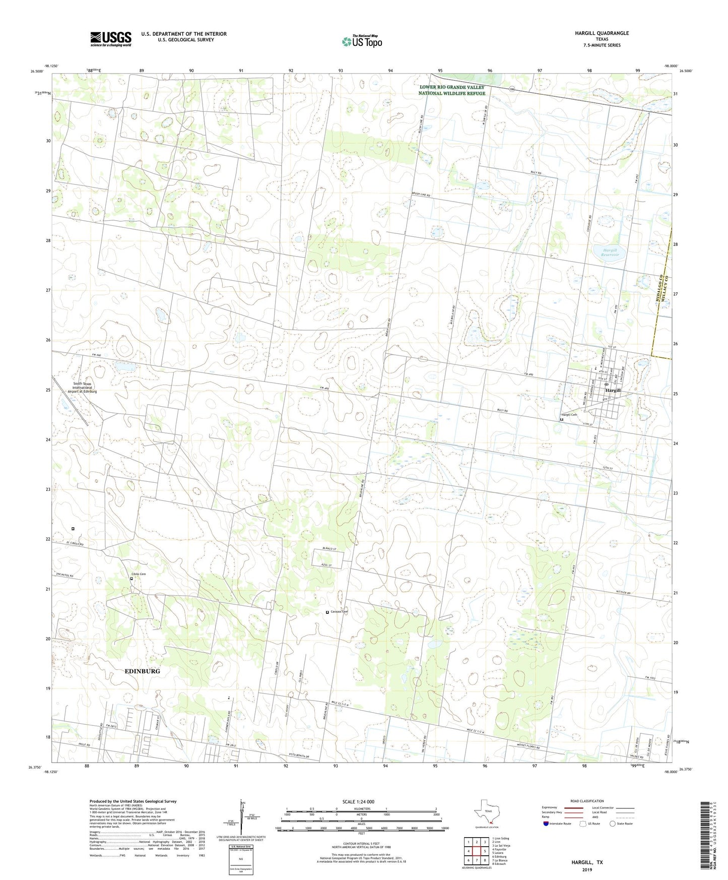
2022 topographic map quadrangle Hargill in the state of Texas. Scale: 1:24000. Based on the newly updated USGS 7.5' US Topo map series, this map is in the following counties: Hidalgo, Willacy. The map contains contour data, water features, and other items you are used to seeing on USGS maps, but also has updated roads and other features. This is the next generation of topographic maps. Printed on high-quality waterproof paper with UV fade-resistant inks.
Quads adjacent to this one:
West: Faysville
Northwest: Linn Siding
North: Linn
Northeast: La Sal Vieja
East: Lasara
Southeast: Edcouch
South: La Blanca
Southwest: Edinburg
This map covers the same area as the classic USGS quad with code o26098d1.
Contains the following named places: Cavazos Cemetery, Cibilo Cemetery, Doolittle Acres Colonia, Edinburg Acres Colonia, Harding Gill Tract Census Designated Place, Harding Gill Tract Colonia, Hargill, Hargill Cemetery, Hargill Census Designated Place, Hargill Post Office, Hargill Reservoir, Hargill Reservoir Levee, Hillcrest Terrace Colonia, Ingle-Doolittle Colonia, La Coma Heights Census Designated Place, La Coma Heights Colonia, La Coma Ranch, Northwest Reservoir, Northwest Reservoir Levee, Omni Ranch Ultralight Flightpark, San Salvador Gas Field, South Texas International Airport at Edinburg, Texas Department of Criminal Justice Manuel A Segovia Unit, Texas Department of Criminal Justice Reynoldo V Lopez State Jail, Triple C Colonia, ZIP Codes: 78542, 78549