MyTopo
Linn Texas US Topo Map
Couldn't load pickup availability
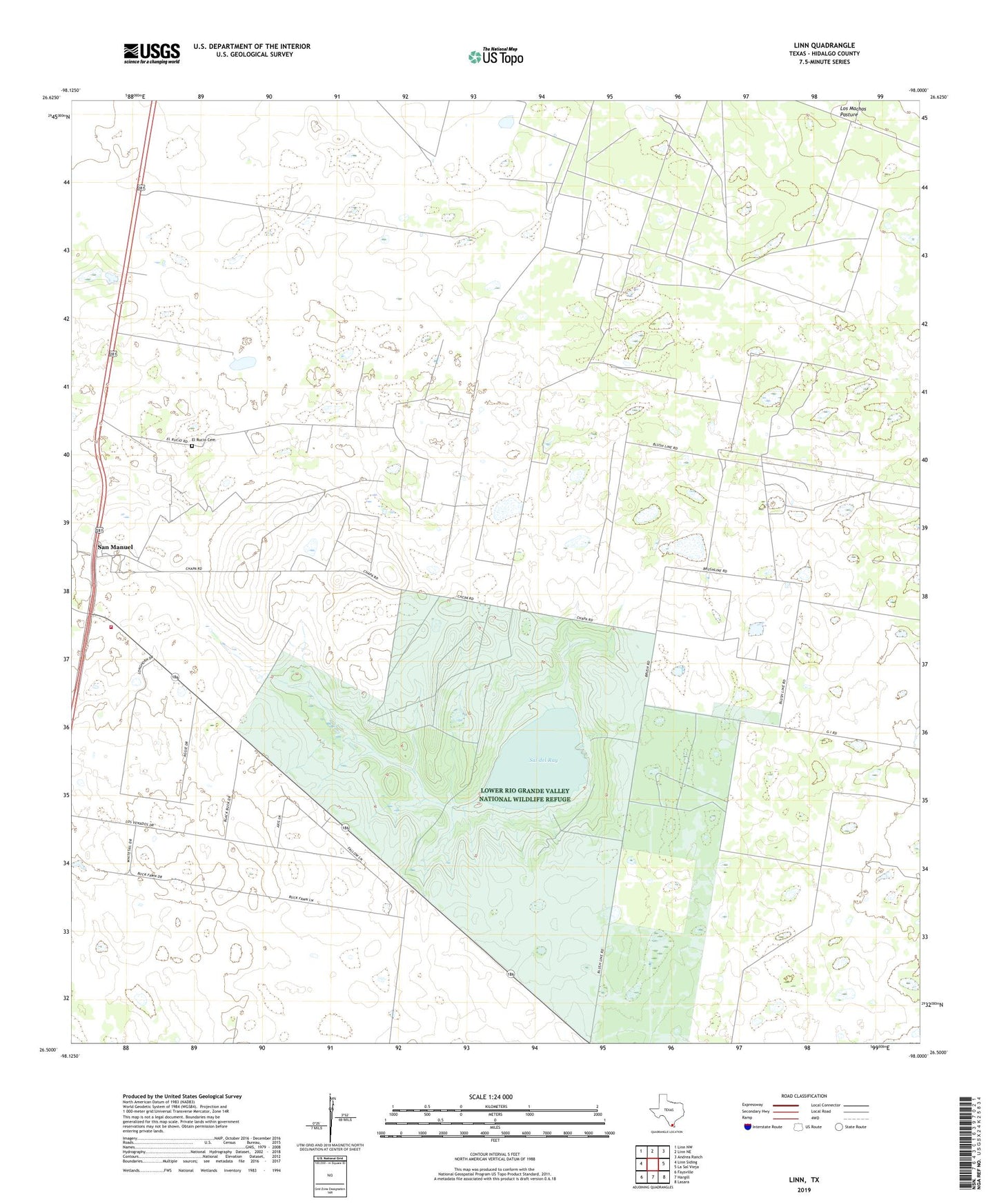
2022 topographic map quadrangle Linn in the state of Texas. Scale: 1:24000. Based on the newly updated USGS 7.5' US Topo map series, this map is in the following counties: Hidalgo. The map contains contour data, water features, and other items you are used to seeing on USGS maps, but also has updated roads and other features. This is the next generation of topographic maps. Printed on high-quality waterproof paper with UV fade-resistant inks.
Quads adjacent to this one:
West: Linn Siding
Northwest: Linn NW
North: Linn NE
Northeast: Andrea Ranch
East: La Sal Vieja
Southeast: Lasara
South: Hargill
Southwest: Faysville
This map covers the same area as the classic USGS quad with code o26098e1.
Contains the following named places: Aquage Windmill, Atole Windmill, Calichera Windmill, El Rancho del Alto, El Rucio Cemetery, El Rucio Ranch, El Toro Windmill, Guajolote Ranch, Guajolote Windmill, Juanita Windmill, La Concepcion Ranch, La Esperansa Windmill, La Nopalosa Ranch, La Nopalosa Windmill, La Santa Rita Windmill, Linn, Linn San Manuel Volunteer Fire Department, Los Angeles Ranch, Los Angeles Windmill, Rancho del Carmine, Sal del Ray, Sal del Rey Gas Field, San Felipe Ranch, San Manuel, San Manuel Gas Field, Taco Ranch, Tres Corrales Ranch, Tres Corrales Windmill