MyTopo
Figure Two Ranch Texas US Topo Map
Couldn't load pickup availability
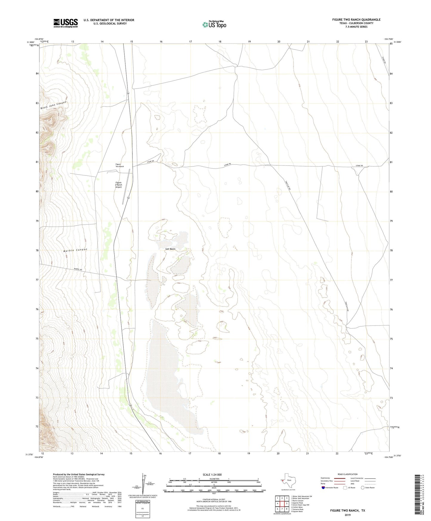
2022 topographic map quadrangle Figure Two Ranch in the state of Texas. Scale: 1:24000. Based on the newly updated USGS 7.5' US Topo map series, this map is in the following counties: Culberson. The map contains contour data, water features, and other items you are used to seeing on USGS maps, but also has updated roads and other features. This is the next generation of topographic maps. Printed on high-quality waterproof paper with UV fade-resistant inks.
Quads adjacent to this one:
West: Apache Peak
Northwest: Bitter Well Mountain SW
North: Bitter Well Mountain
Northeast: Burro Canyon
East: Seven Heart Gap NW
Southeast: Square Mesa
South: Victorio Peak
Southwest: Collier Mesa
This map covers the same area as the classic USGS quad with code o31104d7.
Contains the following named places: Black John Canyon, Dry Bone Well, Figure 2 Ranch Airport, Figure Two Ranch, Fivemile Well, House Well, Marble Canyon, Penn Well, Sal Hepatica Well, Salt Basin, Snake Well, Stevens Well