MyTopo
Flatonia Texas US Topo Map
Couldn't load pickup availability
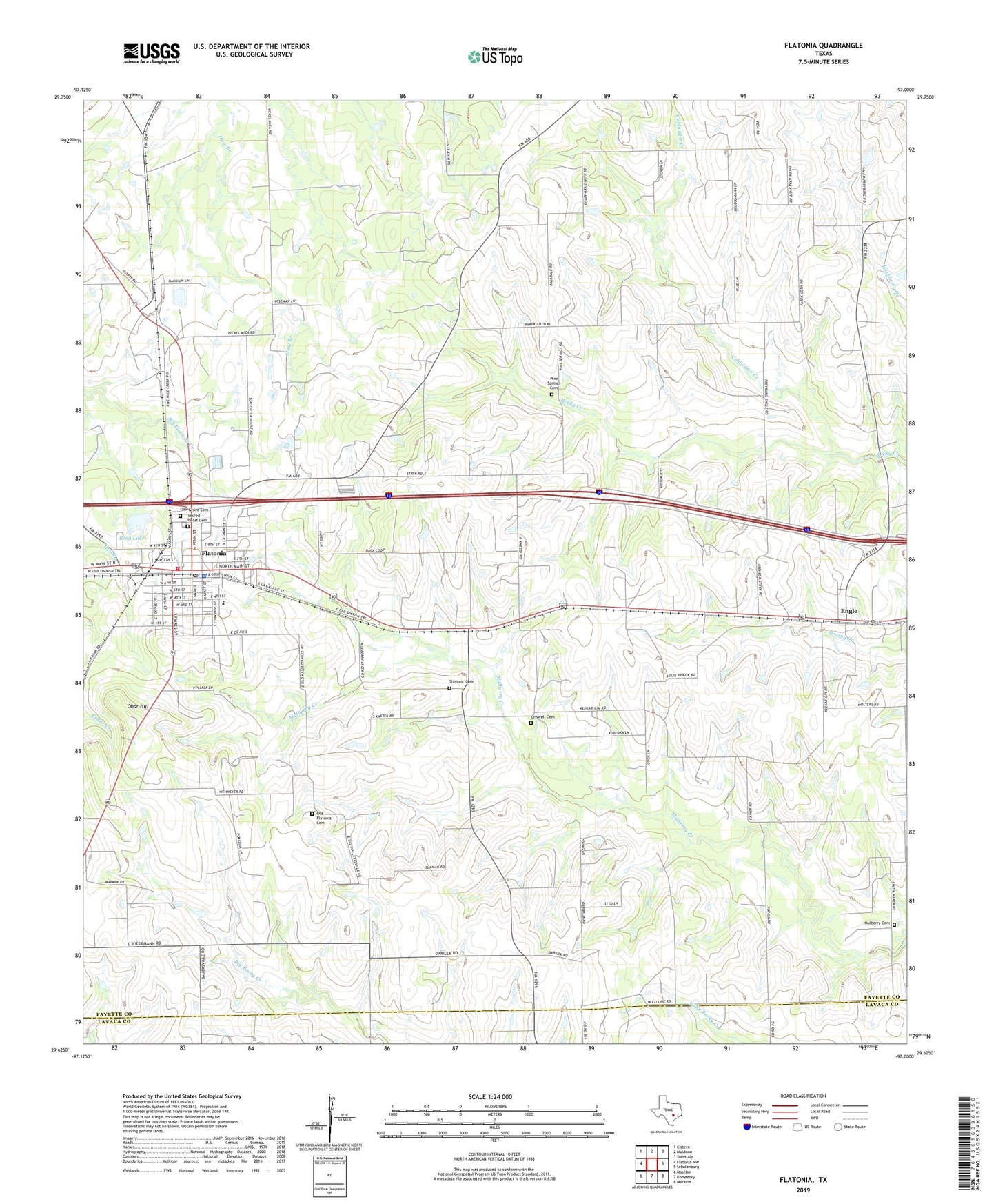
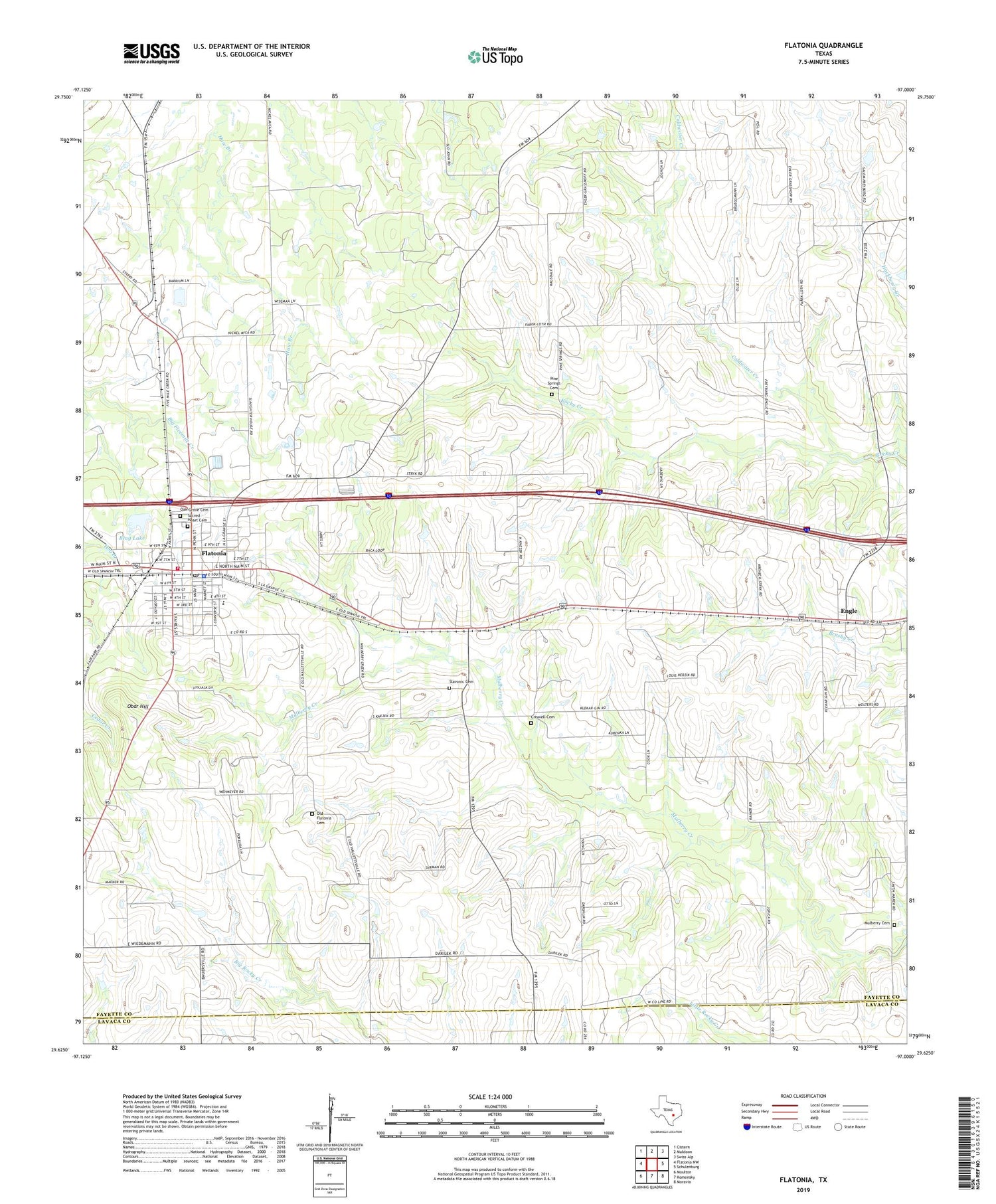
2019 topographic map quadrangle Flatonia in the state of Texas. Scale: 1:24000. Based on the newly updated USGS 7.5' US Topo map series, this map is in the following counties: Fayette, Lavaca. The map contains contour data, water features, and other items you are used to seeing on USGS maps, but also has updated roads and other features. This is the next generation of topographic maps. Printed on high-quality waterproof paper with UV fade-resistant inks.
Quads adjacent to this one:
West: Flatonia NW
Northwest: Cistern
North: Muldoon
Northeast: Swiss Alp
East: Schulenburg
Southeast: Moravia
South: Komensky
Southwest: Moulton
Contains the following named places: Coldwater Creek, Criswell Cemetery, Douglas School, Engle, Fayette County Constable Precinct 3, Fayette County Emergency Medical Services Flatonia, Flatonia, Flatonia Baptist Church, Flatonia City Hall, Flatonia Elementary School, Flatonia High School, Flatonia Police Department, Flatonia Post Office, Flatonia Volunteer Fire Department, Mulberry Cemetery, Oak Grove Cemetery, Obar Hill, Old Flatonia, Old Flatonia Cemetery, Pine Springs Cemetery, Praha, Ring Lake, Ring Lake Dam, Sacred Heart Catholic Church, Sacred Heart Cemetery, Saint Marys Church of the Assumption, Saint Paul African Methodist Episcopal Church, Slavonic Cemetery, Town of Flatonia