MyTopo
Moulton Texas US Topo Map
Couldn't load pickup availability
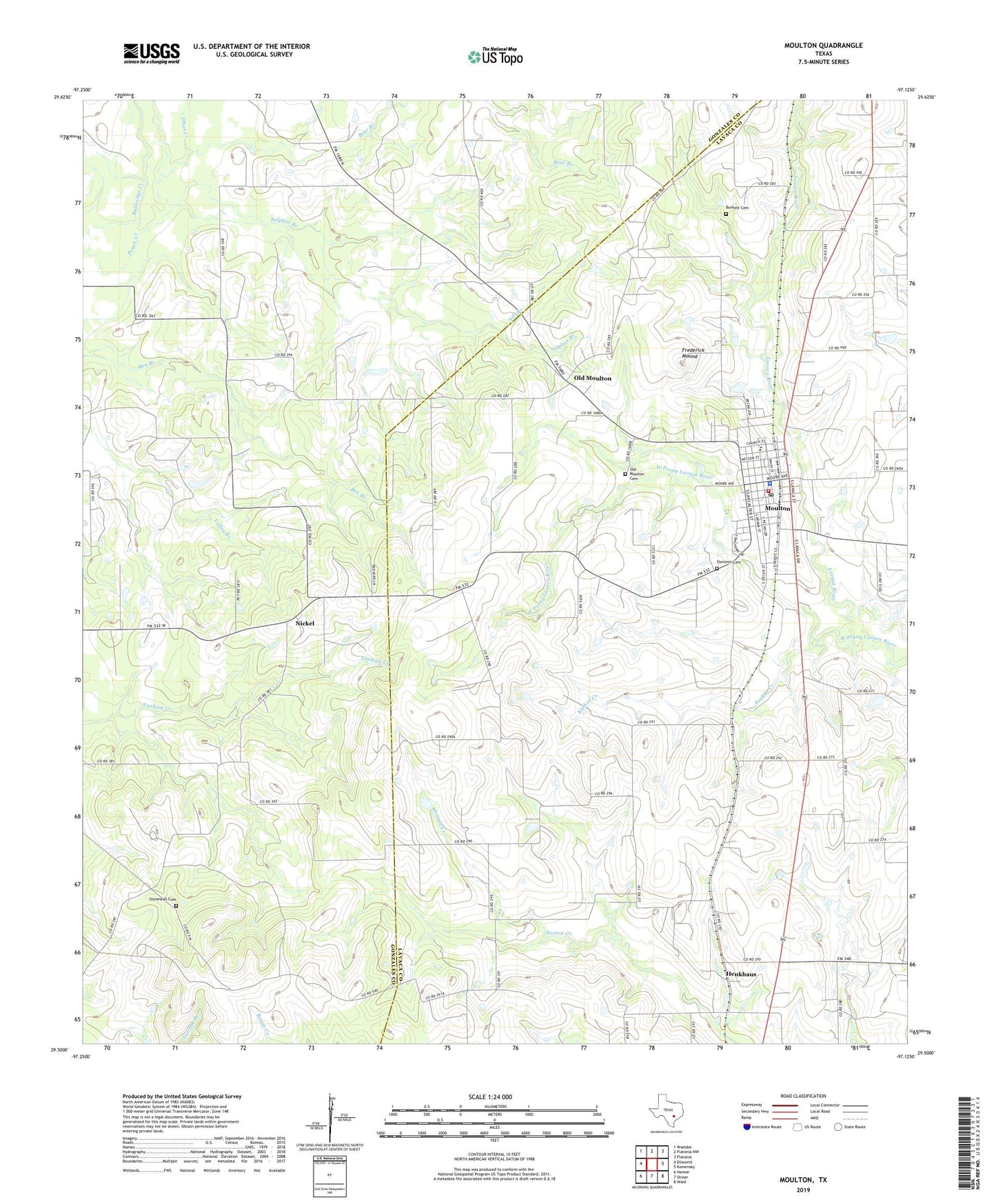
2022 topographic map quadrangle Moulton in the state of Texas. Scale: 1:24000. Based on the newly updated USGS 7.5' US Topo map series, this map is in the following counties: Lavaca, Gonzales. The map contains contour data, water features, and other items you are used to seeing on USGS maps, but also has updated roads and other features. This is the next generation of topographic maps. Printed on high-quality waterproof paper with UV fade-resistant inks.
Quads adjacent to this one:
West: Dilworth
Northwest: Waelder
North: Flatonia NW
Northeast: Flatonia
East: Komensky
Southeast: Wied
South: Shiner
Southwest: Hamon
This map covers the same area as the classic USGS quad with code o29097e2.
Contains the following named places: Baldridge Creek, Bear Branch, Burkett Cemetery, Frederick Mound, Henkhaus, Kuehns Creek, Moulton, Moulton City Hall, Moulton Municipal Airport, Moulton Police Department, Moulton Post Office, Moulton Volunteer Fire Department, Nickel, Obar Creek, Old Moulton, Old Moulton Cemetery, Salt Branch, Slavonic Cemetery, Stonewall Cemetery, Sulphur Branch, Town of Moulton