MyTopo
Flo Texas US Topo Map
Couldn't load pickup availability
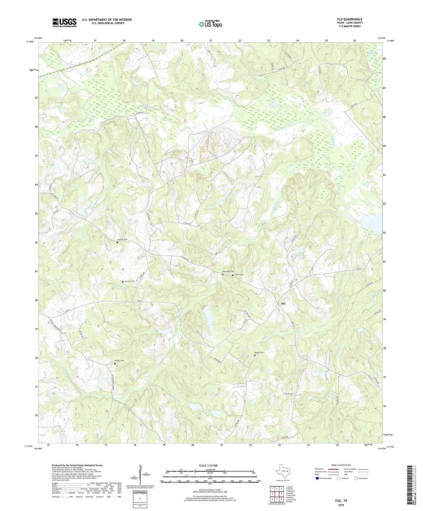
2019 topographic map quadrangle Flo in the state of Texas. Scale: 1:24000. Based on the newly updated USGS 7.5' US Topo map series, this map is in the following counties: Leon. The map contains contour data, water features, and other items you are used to seeing on USGS maps, but also has updated roads and other features. This is the next generation of topographic maps. Printed on high-quality waterproof paper with UV fade-resistant inks.
Quads adjacent to this one:
West: Buffalo
Northwest: Lanely
North: Keechi
Northeast: Oakwood
East: Lake Leon
Southeast: Eunice
South: Centerville
Southwest: Robbins
Contains the following named places: Alligator Creek, Bliss Creek, Brushy Cemetery, Buffalo Oil Field, Cow Slash Creek, Dove Branch, Flo, Lake Elverda, Lone Star High School, Lummus Cemetery, Mustang Creek, Parker Cemetery, Patterson Branch, Red Oak Branch, Schweinle Lake, Schweinle Lake Dam, Stevens Cemetery, Taylor Cemetery, Wheelock Cemetery, Wheelock Creek