MyTopo
Fluvanna Texas US Topo Map
Couldn't load pickup availability
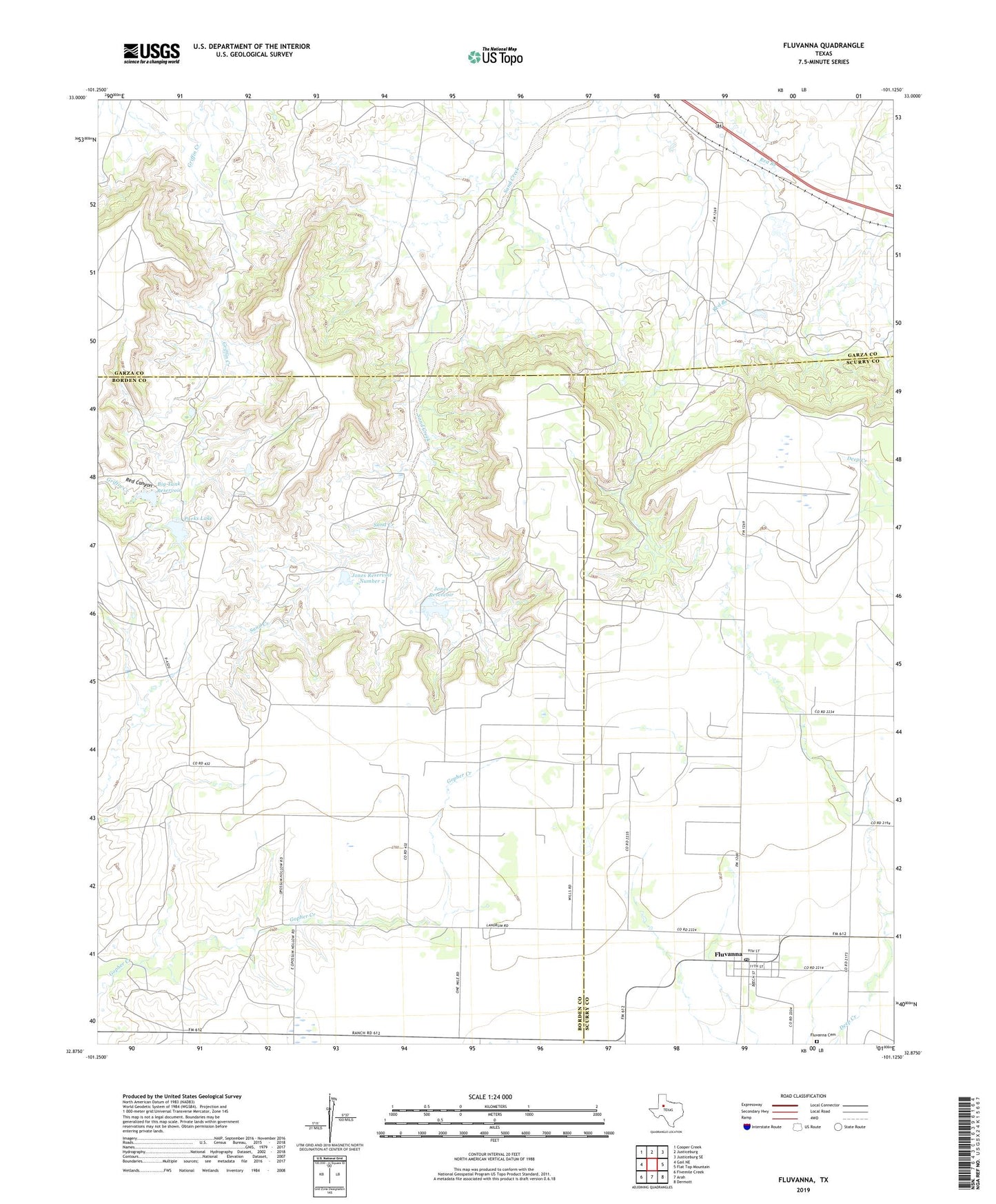
2022 topographic map quadrangle Fluvanna in the state of Texas. Scale: 1:24000. Based on the newly updated USGS 7.5' US Topo map series, this map is in the following counties: Borden, Garza, Scurry. The map contains contour data, water features, and other items you are used to seeing on USGS maps, but also has updated roads and other features. This is the next generation of topographic maps. Printed on high-quality waterproof paper with UV fade-resistant inks.
Quads adjacent to this one:
West: Gail NE
Northwest: Cooper Creek
North: Justiceburg
Northeast: Justiceburg SE
East: Flat Top Mountain
Southeast: Dermott
South: Arah
Southwest: Fivemile Creek
This map covers the same area as the classic USGS quad with code o32101h2.
Contains the following named places: Big Tank Dam, Big Tank Reservoir, Fluvanna, Fluvanna Cemetery, Fluvanna Census Designated Place, Fluvanna Oil Field, Fluvanna Post Office, Jones Number 2 Dam, Jones Number 4 Dam, Jones Reservoir, Jones Reservoir Number 2, Parks Lake, Parks Lake Dam, Post Emitter Site, Red Canyon, ZIP Code: 79517