MyTopo
Franklin Bend Texas US Topo Map
Couldn't load pickup availability
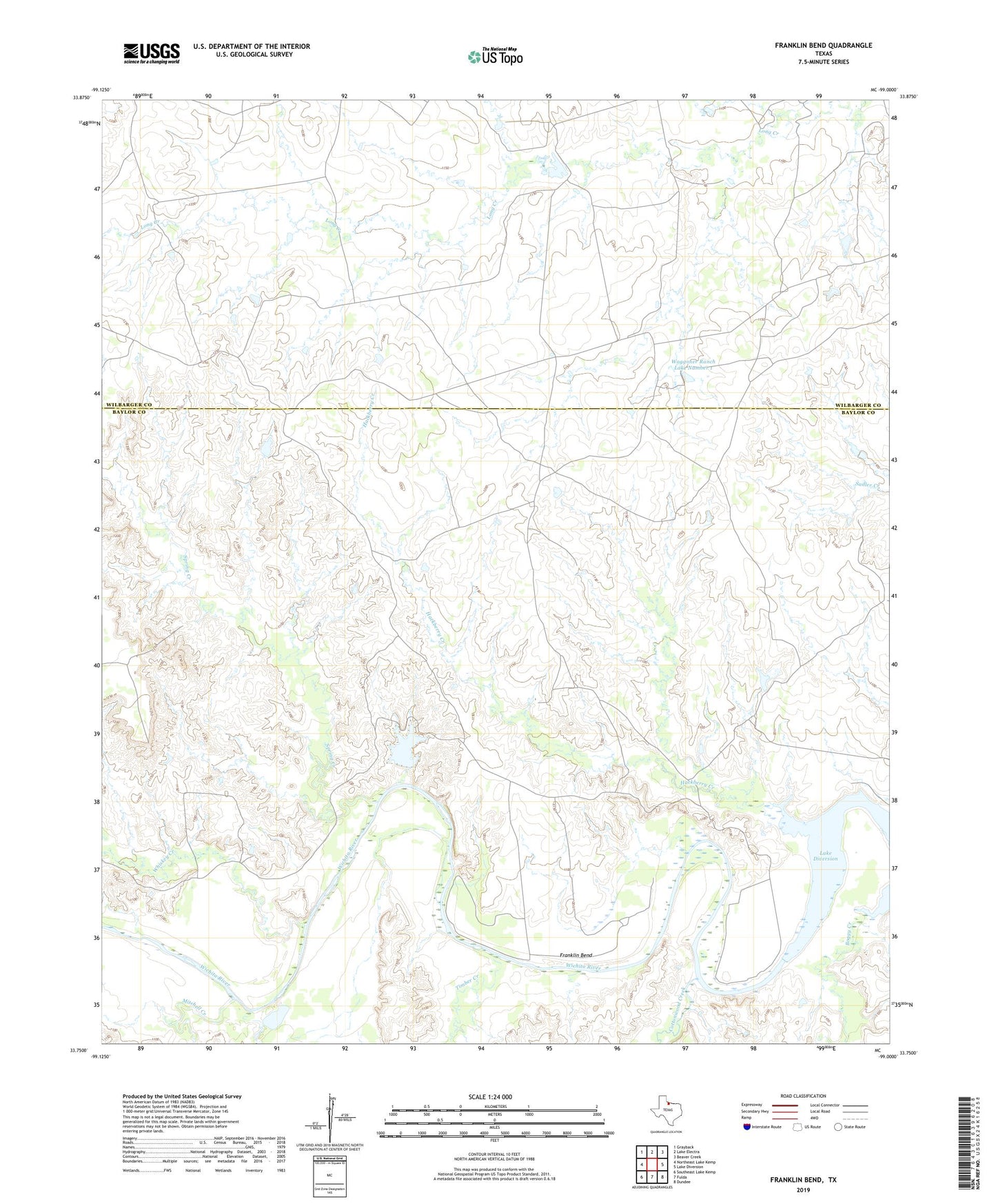
2019 topographic map quadrangle Franklin Bend in the state of Texas. Scale: 1:24000. Based on the newly updated USGS 7.5' US Topo map series, this map is in the following counties: Baylor, Wilbarger. The map contains contour data, water features, and other items you are used to seeing on USGS maps, but also has updated roads and other features. This is the next generation of topographic maps. Printed on high-quality waterproof paper with UV fade-resistant inks.
Quads adjacent to this one:
West: Northeast Lake Kemp
Northwest: Grayback
North: Lake Electra
Northeast: Beaver Creek
East: Lake Diversion
Southeast: Dundee
South: Fulda
Southwest: Southeast Lake Kemp
Contains the following named places: Boggy Creek, Cottonwood Creek, Franklin Bend, Hackberry Creek, La Paloma Cow Camp, Mitchell Creek, Spring Creek, Sweet La Cruz Cow Camp, Timber Creek, Waggoner Ranch Lake Number 1, Waggoner Ranch Lake Number 1 Dam, Whiskey Creek