MyTopo
Lake Electra Texas US Topo Map
Couldn't load pickup availability
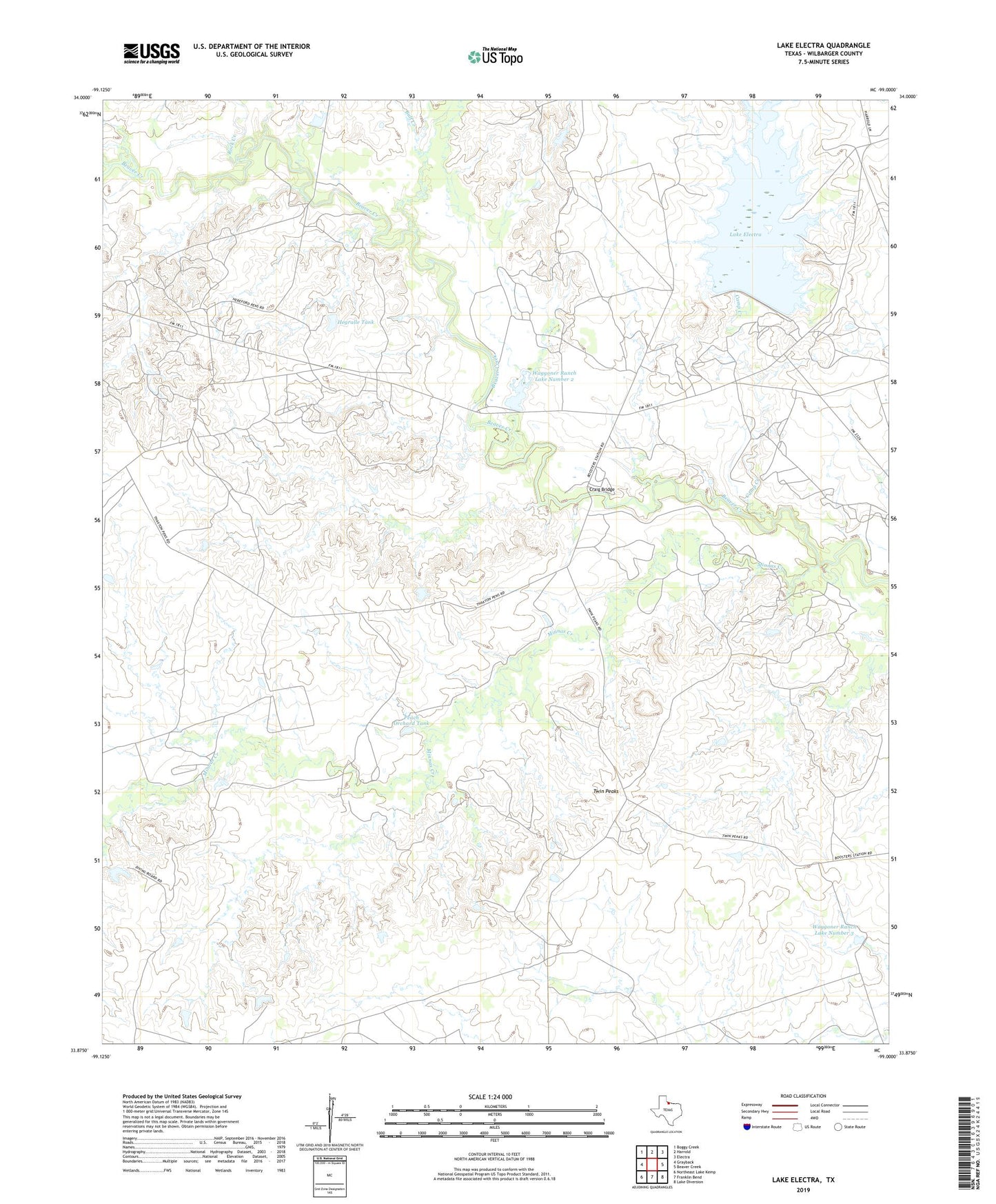
2022 topographic map quadrangle Lake Electra in the state of Texas. Scale: 1:24000. Based on the newly updated USGS 7.5' US Topo map series, this map is in the following counties: Wilbarger. The map contains contour data, water features, and other items you are used to seeing on USGS maps, but also has updated roads and other features. This is the next generation of topographic maps. Printed on high-quality waterproof paper with UV fade-resistant inks.
Quads adjacent to this one:
West: Grayback
Northwest: Boggy Creek
North: Harrold
Northeast: Electra
East: Beaver Creek
Southeast: Lake Diversion
South: Franklin Bend
Southwest: Northeast Lake Kemp
This map covers the same area as the classic USGS quad with code o33099h1.
Contains the following named places: Boggy Creek, Bull Creek, Camp Creek, Craig Bridge, Hegralle Tank, Hegralle Tank Dam, Kite Pens, Lake Electra, Lake Electra Dam, Minnas Creek, Peach Orchard Tank, Red Pasture Pens, Rock Creek, Thaxton Pens, Twin Peaks, Waggoner Ranch Lake Number 2, Waggoner Ranch Lake Number 2 Dam, Waggoner Ranch Lake Number 3, Waggoner Ranch Lake Number 3 Dam