MyTopo
Grayback Texas US Topo Map
Couldn't load pickup availability
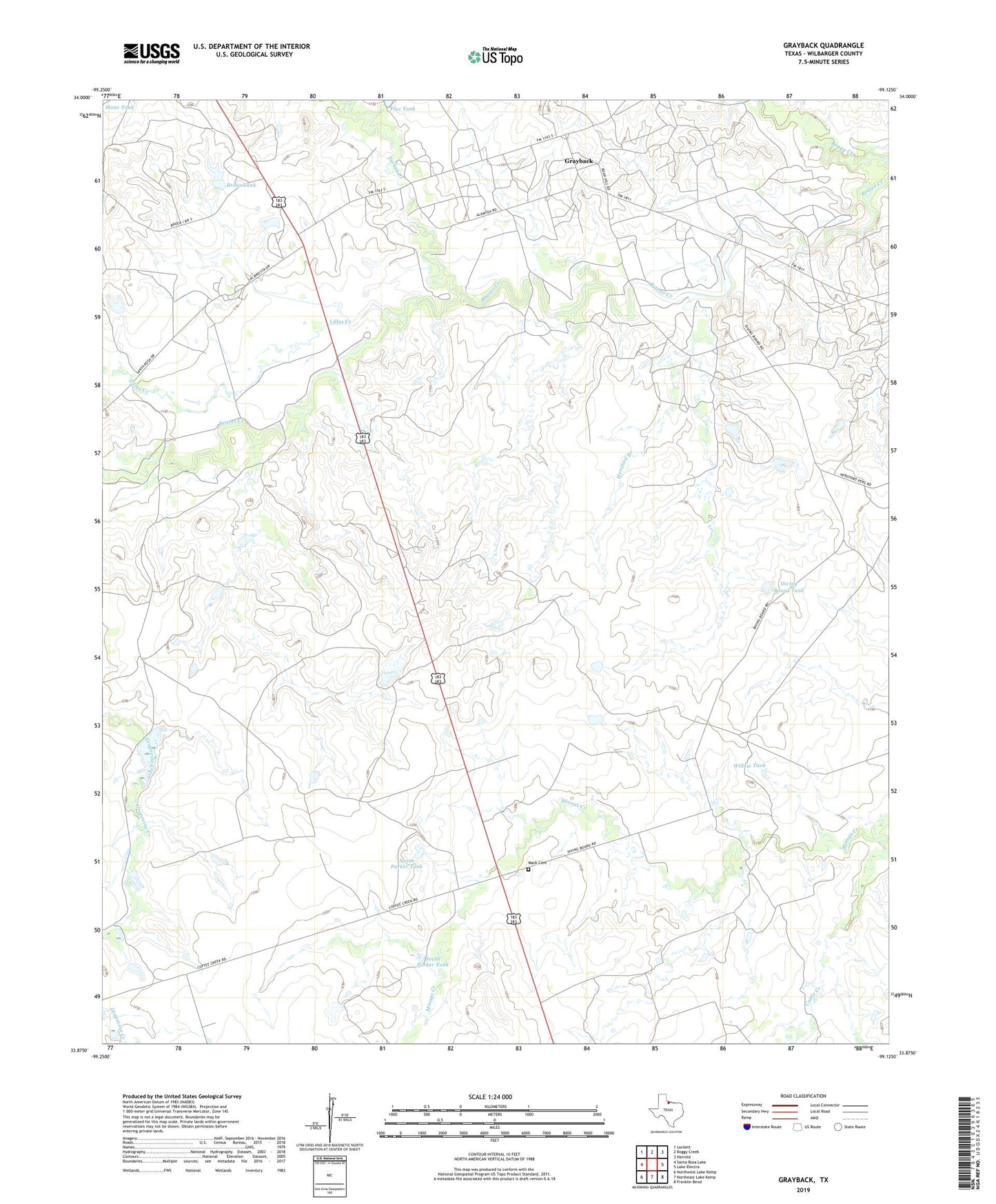
2022 topographic map quadrangle Grayback in the state of Texas. Scale: 1:24000. Based on the newly updated USGS 7.5' US Topo map series, this map is in the following counties: Wilbarger. The map contains contour data, water features, and other items you are used to seeing on USGS maps, but also has updated roads and other features. This is the next generation of topographic maps. Printed on high-quality waterproof paper with UV fade-resistant inks.
Quads adjacent to this one:
West: Santa Rosa Lake
Northwest: Lockett
North: Boggy Creek
Northeast: Harrold
East: Lake Electra
Southeast: Franklin Bend
South: Northeast Lake Kemp
Southwest: Northwest Lake Kemp
This map covers the same area as the classic USGS quad with code o33099h2.
Contains the following named places: Alamosa Camp, Bronc Tank, Burnett Pens, Cattle Creek, Cottonwood Pens, Diving Board Tank, Grayback, Hereford Branch, Hereford Pens, Hoot and Holler Crossing, Lillus Creek, Mack Cemetery, Midway Crossing, North Parker Tank, Rock Crossing, South Parker Tank, Turkey Creek, Willow Tank, Zacaweista Ranch