MyTopo
Beaver Creek Texas US Topo Map
Couldn't load pickup availability
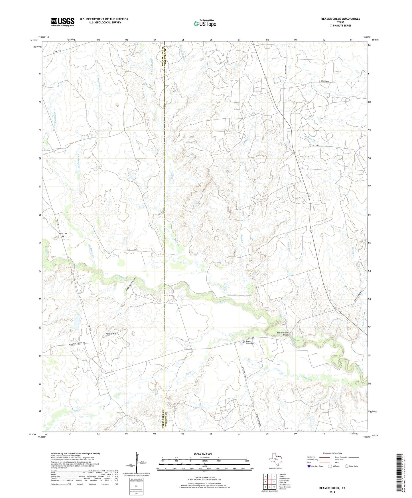
2022 topographic map quadrangle Beaver Creek in the state of Texas. Scale: 1:24000. Based on the newly updated USGS 7.5' US Topo map series, this map is in the following counties: Wichita, Wilbarger. The map contains contour data, water features, and other items you are used to seeing on USGS maps, but also has updated roads and other features. This is the next generation of topographic maps. Printed on high-quality waterproof paper with UV fade-resistant inks.
Quads adjacent to this one:
West: Lake Electra
Northwest: Harrold
North: Electra
Northeast: Sunshine Hill
East: Fowlkes
Southeast: Mankins
South: Lake Diversion
Southwest: Franklin Bend
This map covers the same area as the classic USGS quad with code o33098h8.
Contains the following named places: Beaver Creek Bridge, Beaver Creek Cemetery, Bluff Creek, Consolidated Oil Field, Coon Creek, East Fork Bluff Creek, Electra Oil Field, Long Creek, Potato Hill, Ronda Cemetery, Rough Creek, Short Creek, Steinman Hollow, Sunflower Creek, Waggoner Ranch Lake Number 6, Waggoner Ranch Lake Number 6 Dam, West Fork Bluff Creek, West Fork Sunflower Creek, ZIP Code: 76360