MyTopo
Gainesville South Texas US Topo Map
Couldn't load pickup availability
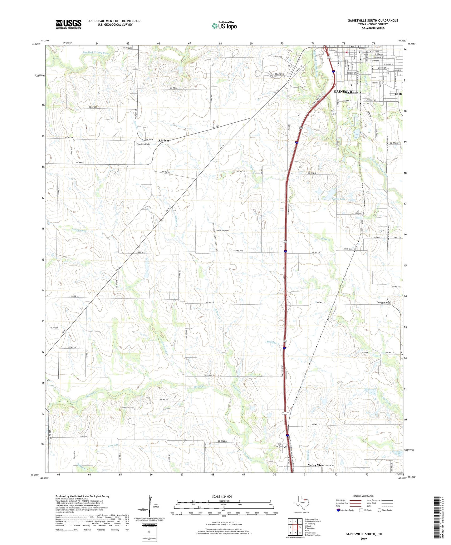
2019 topographic map quadrangle Gainesville South in the state of Texas. Scale: 1:24000. Based on the newly updated USGS 7.5' US Topo map series, this map is in the following counties: Cooke. The map contains contour data, water features, and other items you are used to seeing on USGS maps, but also has updated roads and other features. This is the next generation of topographic maps. Printed on high-quality waterproof paper with UV fade-resistant inks.
Quads adjacent to this one:
West: Hood
Northwest: Muenster East
North: Gainesville North
Northeast: Callisburg
East: Woodbine
Southeast: Mountain Springs
South: Valley View
Southwest: Era
Contains the following named places: Alvarado Public Library, Antioch Baptist Church, Calvary Church, Cloud-Stark House, Cook, Cooke County Emergency Medical Service, Cooke County Highway Patrol, Cooke County Junior College, Dry Elm Creek, Faith Temple Church, First Presbyterian Church, Freedom Field, Gainesville Alternative School, Gainesville Fire Department Station 3, Gainesville High School, Gainesville Municipal Building, Gainesville Post Office, Garden Valley Church, J M Lindsay Elementary School, Leeper Stadium, Leonard Park, Leopard Stadium, Lindsay Elementary School, Lindsay School, McMurray Elementary School, McMurray School, Morton Museum of Cooke County, Mount Hope Church, Sarles Lake, Sarles Lake Dam, Soil Conservation Service Site 61q Dam, Soil Conservation Service Site 61q Reservoir, Southside Baptist Church, Spring Creek Church, Stahl Airport, Terrapin Hill, Townsend Creek, Valley View Cemetery, William and Anna Davis House, Willow Creek